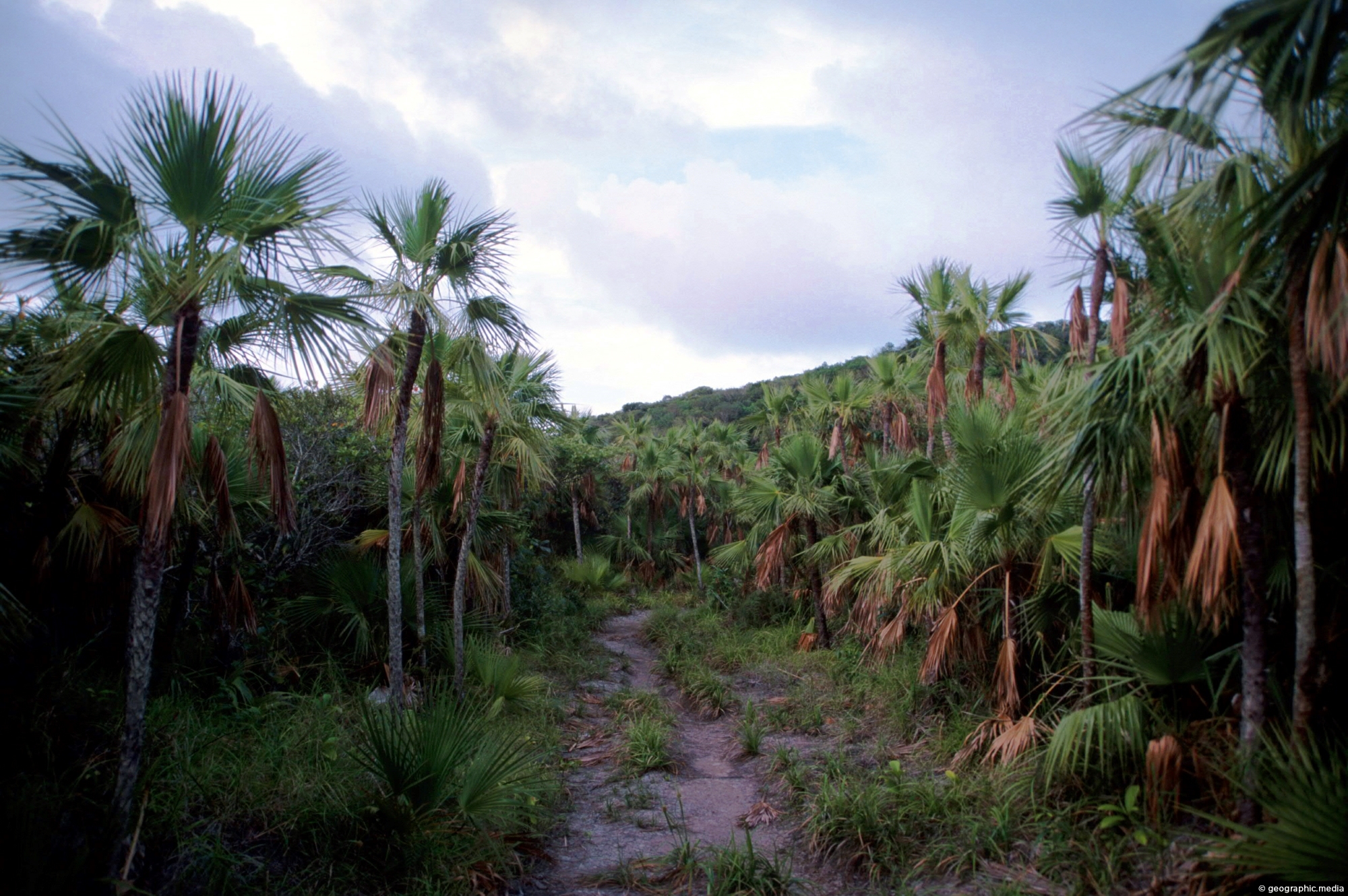
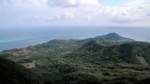
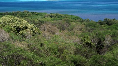
This trail through a palms forest eventually leads to the mountainous interior of Providencia Island. The highest peak on the island is El Pico, which stands at 360 meters (1181 feet) above sea level and offers 360 degree views of the island.
ALL / Explore South America / Explore Colombia / Colombia Photos / Providencia photos / Palms and Trail in Providencia
All original royalty-free photos, shareable maps, and informative articles.
Palms and Trail in Providencia
Page Views
This post has been viewed 270 times
Related Articles
-
Providencia Island Interior
Providencia photos, Islands, Landscape / Horizontal, Mountains, Sea
Looking down from the highest point in the interior of Providencia Island at the surrounding landscape. Unlike nearby San...
-
Santa Catalina as seen from Providencia
Providencia photos, Islands, Landscape / Horizontal, Reefs, Sea
Santa Catalina is an island connected to Providencia Island by a wharf. Both these islands were once connected by...
-
Sunset at Providencia
Providencia photos, Islands, Portrait / Vertical, Reefs, Sea
Vibrant hues of orange, pink, and red streak across the sky at Providencia Island in the Caribbean Sea.
-
Southwest Bay Providencia Island
Providencia photos, Beaches, Islands, Landscape / Horizontal, Sea
Southwest Bay is one of the main beaches on Providencia Island. Manzanillo Bay is the other main beach on...
-
Coral Reef Providencia Island
Providencia photos, Coral, Islands, Landscape / Horizontal, Sea
Coral Reef off the coast of Providencia Island in the Caribbean Sea. Providencia also called Isla de Providencia is...
-
Manzanillo Beach
Providencia photos, Beaches, Islands, Landscape / Horizontal, Palms, Sea, Trees
Manzanillo beach is a long white sand beach located along the southeastern coast of the Caribbean island of Providencia....
-
Manzanillo Bay in Providencia, Colombia
Providencia photos, Beaches, Landscape / Horizontal, Palms, Sea
Looking at scenic Manzanillo Bay on Colombia’s Providencia Island. The bay is one of a handful of beaches located...
-
View of Santa Catalina Island
Providencia photos, Islands, Landscape / Horizontal, Mountains, Sea
View of Santa Catalina Island as seen from the mountainous interior of Providencia Island. The exact location is the...
0 Comments
Calendar
M | T | W | T | F | S | S |
---|---|---|---|---|---|---|
1 | 2 | 3 | 4 | |||
5 | 6 | 7 | 8 | 9 | 10 | 11 |
12 | 13 | 14 | 15 | 16 | 17 | 18 |
19 | 20 | 21 | 22 | 23 | 24 | 25 |
26 | 27 | 28 | 29 | 30 | 31 |
Popular Posts
- Awakening New Zealand video (100)
- Iguazu Falls as seen from Brazil (87)
- Metrocable Medellin (78)
- Pauatahanui Inlet (69)
- Spinnaker Hill in Whitby Porirua (68)
- Spinnaker Hill View (68)
- View from Whitby (68)
- The Devil’s Throat (62)
- Aerial View of Iguazu Falls (61)
- Porirua Harbour & Papakowhai (57)
- Lake Wakatipu (57)
- Salto Rivadavia & Iguassu River (56)
- Lake Tekapo & Lupins (54)
- Nelson View (53)
- Salto Rivadavia Misiones Province (53)
- Cascadas at Iguazu (53)
Subjects
AccommodationAnimalsArchitectureBeachesBirdsBoatsBridgesBuildingsCarsChurchesCitiesCoralCultureExtra Wide HorizontalFlowersForestsHarborsHomesIslandsLakesLandscape / HorizontalMapsMenMonumentsMountainsPalmsParksPeoplePlantsPortrait / VerticalRiversRoadsRuralSeaShopsSkyscrapersSnowSunsetsTownsTrailsTransportTreesVideosVolcanicWaterfalls
Recent Comments
- Lance on Concrete Hut Wainuiomata
- Tony on Concrete Hut Wainuiomata
- DavidJ on Wellington Night Skyline
- Ben on Auckland City Skyline from Westhaven Marina in 1998
- Ben on Auckland Harbour Bridge view