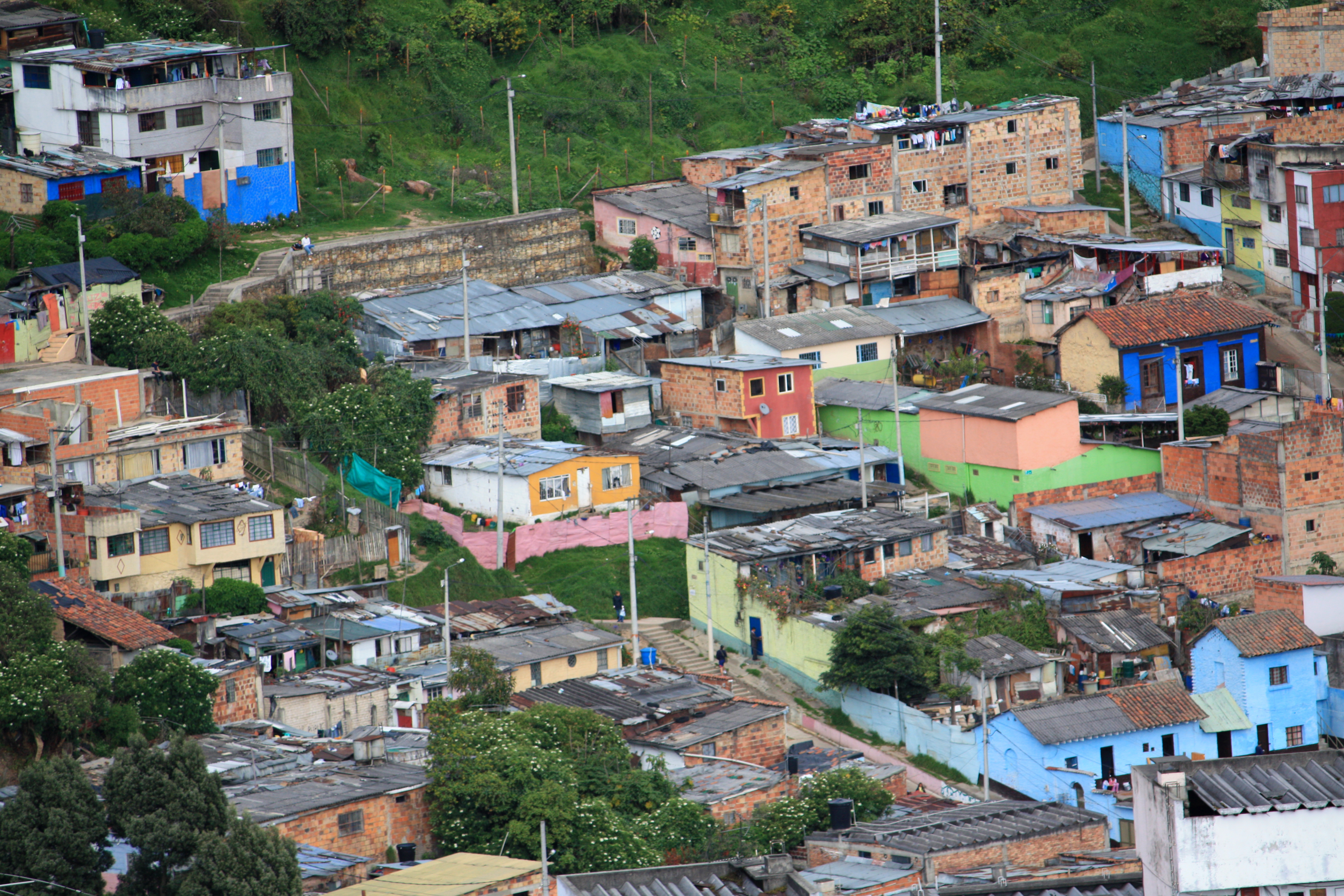
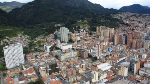
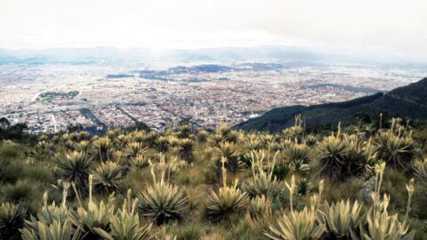
Many barrios in Bogotá are considered low income areas. The economically disadvantaged who cannot afford to live in the city often build homes in the outskirts of the city, often on the surrounding hillsides.
ALL / Explore South America / Explore Colombia / Colombia Photos / Bogota photos / Poor Barrios in Bogota
All original royalty-free photos, shareable maps, and informative articles.
Poor Barrios in Bogota
Page Views
This post has been viewed 358 times
Related Articles
-
South Bogota 2002
Bogota photos, Buildings, Cities, Landscape / Horizontal
Looking at south Bogota in Colombia from the central business district, (circa 2002). See the same photo seven years...
-
South CBD of Bogota in Colombia
Bogota photos, Buildings, Cities, Landscape / Horizontal
Looking south from the central CBD of Bogota with part of the CBD in view. Photo was taken in...
-
Building in Chapinero
Bogota photos, Buildings, Cars, Homes, Portrait / Vertical
Looking at a commercial building in Chapinero, Bogota. Chapinero is situated in the northern part of the city. It...
-
Bogota View from Chia
Bogota photos, Landscape / Horizontal, Mountains, Rural, Towns
Looking toward northern Bogota in the distance from the satellite town of Chia, as seen from atop the La...
-
Carrera 68d Bogota
Bogota photos, Architecture, Buildings, Homes, Landscape / Horizontal
Carrera 68d is a street located in Bogotá, Colombia. It is located in the north-central part of the city...
-
Santa Teresa de Avila Church Bogota
Bogota photos, Buildings, Churches, Portrait / Vertical
Santa Teresa de Avila Church is a Catholic church located in the suburb of Barrios Unidos in Bogota, the...
-
South-eastern Bogota
Bogota photos, Buildings, Cities, Landscape / Horizontal, Skyscrapers
View of a section of south-eastern Bogota as seen from a building in the CBD.
-
San Alejo Market in Bogota Colombia
Bogota photos, People, Portrait / Vertical
San Alejo Market is a flea market in Bogota that sells art, crafts, and souvenirs. It sells wares from...
0 Comments
Calendar
M | T | W | T | F | S | S |
---|---|---|---|---|---|---|
1 | 2 | 3 | 4 | |||
5 | 6 | 7 | 8 | 9 | 10 | 11 |
12 | 13 | 14 | 15 | 16 | 17 | 18 |
19 | 20 | 21 | 22 | 23 | 24 | 25 |
26 | 27 | 28 | 29 | 30 | 31 |
Popular Posts
- Awakening New Zealand video (100)
- Iguazu Falls as seen from Brazil (87)
- Metrocable Medellin (78)
- Pauatahanui Inlet (69)
- Spinnaker Hill View (68)
- Spinnaker Hill in Whitby Porirua (68)
- View from Whitby (68)
- The Devil’s Throat (62)
- Aerial View of Iguazu Falls (61)
- Porirua Harbour & Papakowhai (57)
- Lake Wakatipu (57)
- Salto Rivadavia & Iguassu River (56)
- Lake Tekapo & Lupins (54)
- Nelson View (53)
- Salto Rivadavia Misiones Province (53)
- Cascadas at Iguazu (53)
Subjects
AccommodationAnimalsArchitectureBeachesBirdsBoatsBridgesBuildingsCarsChurchesCitiesCoralCultureExtra Wide HorizontalFlowersForestsHarborsHomesIslandsLakesLandscape / HorizontalMapsMenMonumentsMountainsPalmsParksPeoplePlantsPortrait / VerticalRiversRoadsRuralSeaShopsSkyscrapersSnowSunsetsTownsTrailsTransportTreesVideosVolcanicWaterfalls
Recent Comments
- Lance on Concrete Hut Wainuiomata
- Tony on Concrete Hut Wainuiomata
- DavidJ on Wellington Night Skyline
- Ben on Auckland City Skyline from Westhaven Marina in 1998
- Ben on Auckland Harbour Bridge view