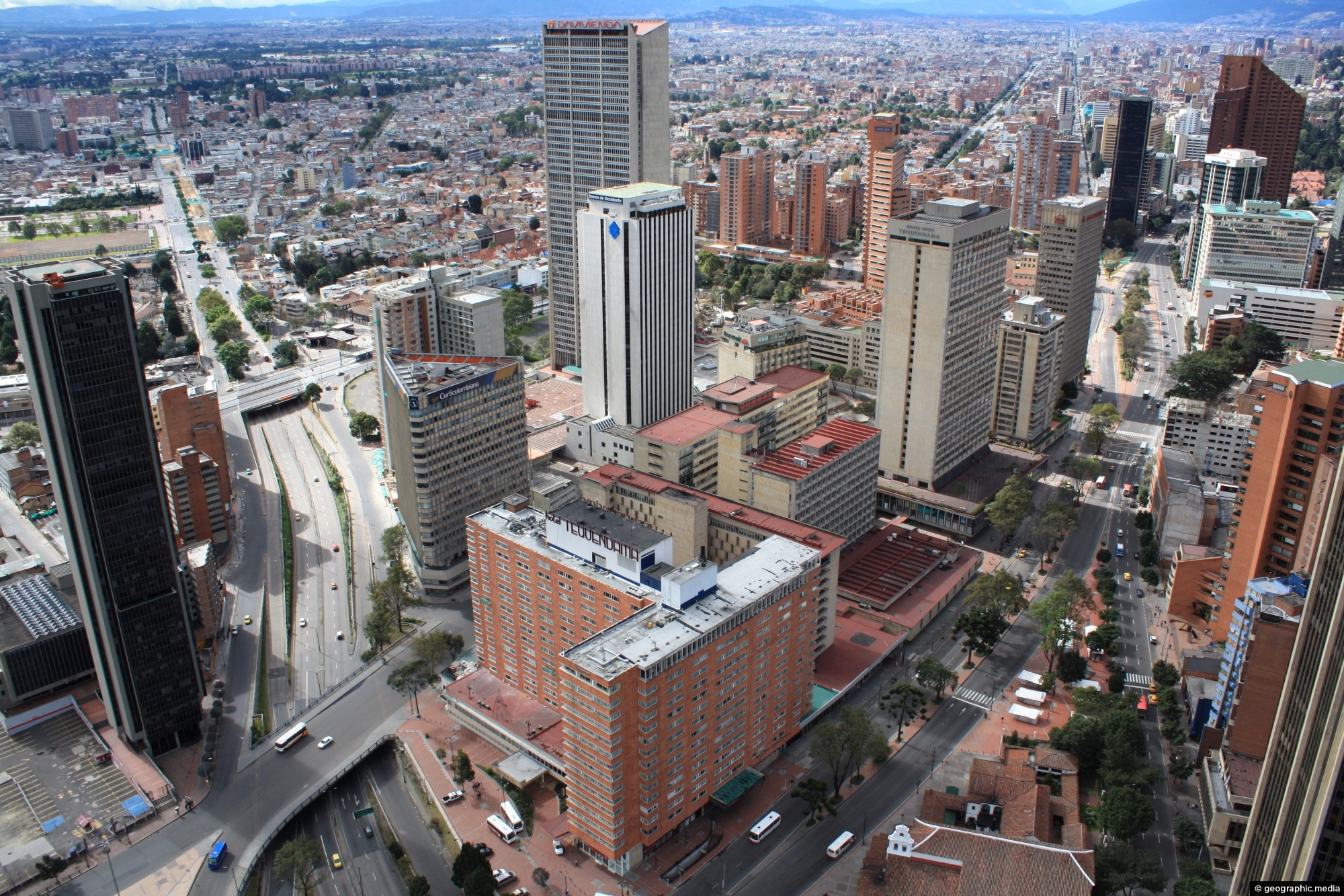
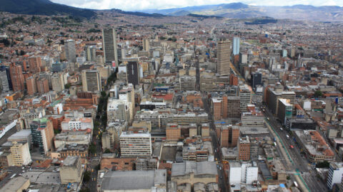
View of Avenida El Dorado where it crosses over Carrera 10 in the CBD of Bogotá. Avenida El Dorado connects the city’s international airport called El Dorado International Airport, to downtown and other important locations.
Avenida El Dorado
Page Views
This post has been viewed 293 times
Related Articles
-
Barrios on Hillside
Bogota photos, Cities, Forests, Homes, Landscape / Horizontal, Roads
Millions of people in Bogota cannot afford to live in the city of Bogota. So they have built their...
-
Edificio Seguros Tequendama Building in Bogota
Bogota photos, Buildings, Portrait / Vertical, Skyscrapers
The Edificio Seguros Tequendama is a skyscraper located in Bogotá, Colombia. It was completed in 1956, and at the...
-
Santamaría Bullring in Bogota
Bogota photos, Buildings, Cities, Homes, Landscape / Horizontal, Skyscrapers, Stadiums
Pictured is the Santamaría Bullring and nearby Park Towers in Bogota, circa 2009. The bullring is still used for...
-
Santa Teresa de Avila Church Bogota
Bogota photos, Buildings, Churches, Portrait / Vertical
Santa Teresa de Avila Church is a Catholic church located in the suburb of Barrios Unidos in Bogota, the...
-
Stately Home in La Merced Bogota
Bogota photos, Buildings, Homes, Landscape / Horizontal
Looking at a stately home in the Bogota suburb of La Merced. Originally constructed by BP Oil for their...
-
Maloka Museum in Bogota Colombia
Bogota photos, Architecture, Buildings, Cities, Landscape / Horizontal
Maloka Museum in Bogota is an interactive science museum located in the suburb of Ciudad Salitre. It includes exhibits...
-
Poor Barrios in Bogota
Bogota photos, Homes, Landscape / Horizontal, Roads
Many barrios in Bogotá are considered low income areas. The economically disadvantaged who cannot afford to live in the...
-
Wealthy Suburb of Rosales in Bogotá
Bogota photos, Buildings, Cities, Homes, Landscape / Horizontal, Roads
View of Calle 71 in the wealthy suburb of Rosales, Bogotá, Colombia. The suburb lies in the Chapinero district...
0 Comments
Calendar
M | T | W | T | F | S | S |
---|---|---|---|---|---|---|
1 | 2 | |||||
3 | 4 | 5 | 6 | 7 | 8 | 9 |
10 | 11 | 12 | 13 | 14 | 15 | 16 |
17 | 18 | 19 | 20 | 21 | 22 | 23 |
24 | 25 | 26 | 27 | 28 | 29 | 30 |
31 |
Popular Posts
- Awakening New Zealand video (100)
- Iguazu Falls as seen from Brazil (87)
- Metrocable Medellin (78)
- Pauatahanui Inlet (69)
- Spinnaker Hill in Whitby Porirua (68)
- Spinnaker Hill View (68)
- View from Whitby (68)
- The Devil’s Throat (62)
- Aerial View of Iguazu Falls (61)
- Porirua Harbour & Papakowhai (57)
- Lake Wakatipu (57)
- Salto Rivadavia & Iguassu River (56)
- Lake Tekapo & Lupins (54)
- Nelson View (53)
- Salto Rivadavia Misiones Province (53)
- Cascadas at Iguazu (53)
Subjects
AccommodationAnimalsArchitectureBeachesBirdsBoatsBridgesBuildingsCarsChurchesCitiesCoralCultureExtra Wide HorizontalFlowersForestsHarborsHomesIslandsLakesLandscape / HorizontalMapsMenMonumentsMountainsPalmsParksPeoplePlantsPortrait / VerticalRiversRoadsRuralSeaShopsSkyscrapersSnowSunsetsTownsTrailsTransportTreesVideosVolcanicWaterfalls
Recent Comments
- Lance on Concrete Hut Wainuiomata
- Tony on Concrete Hut Wainuiomata
- DavidJ on Wellington Night Skyline
- Ben on Auckland City Skyline from Westhaven Marina in 1998
- Ben on Auckland Harbour Bridge view