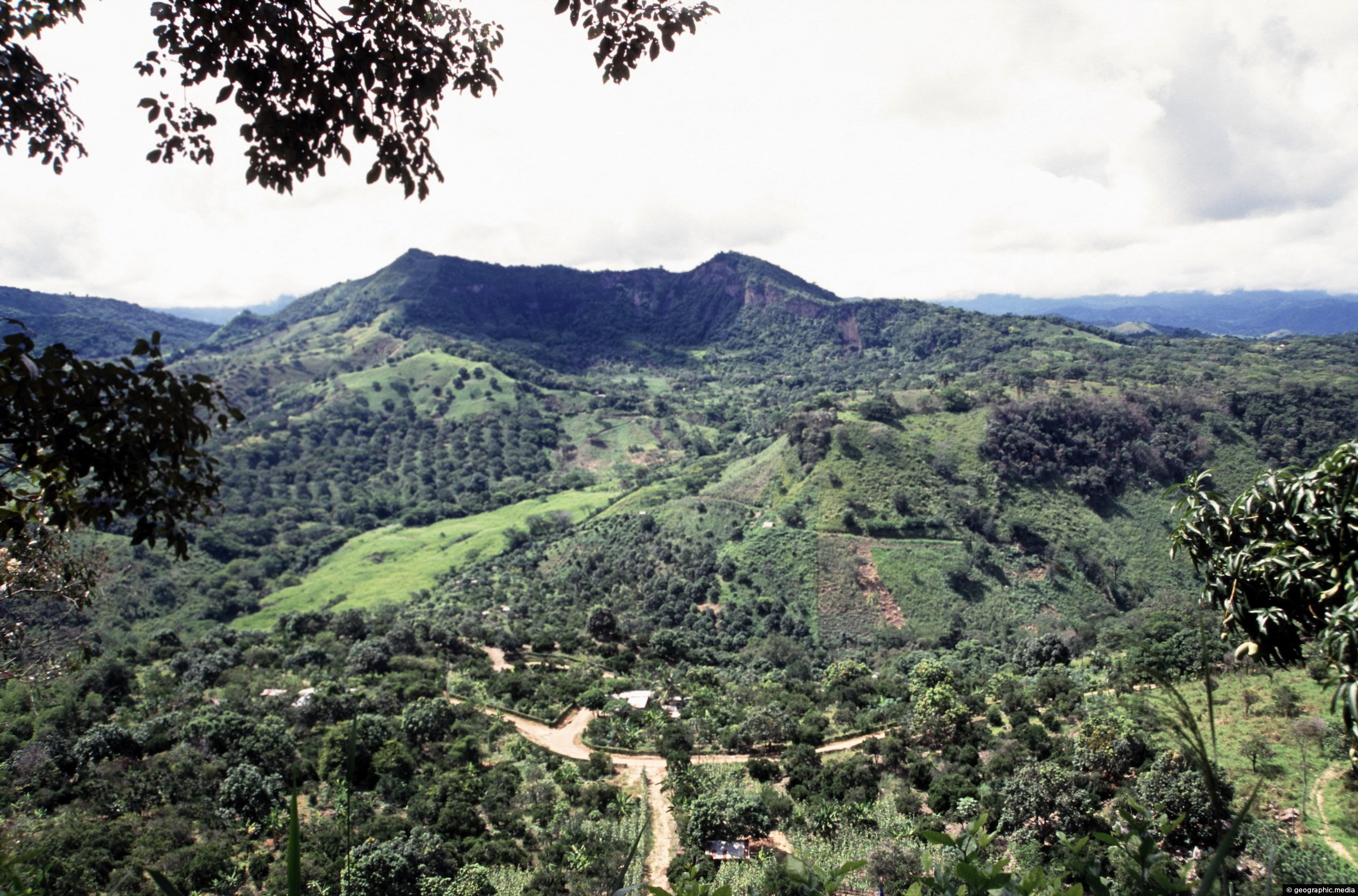
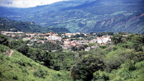
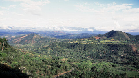
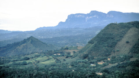
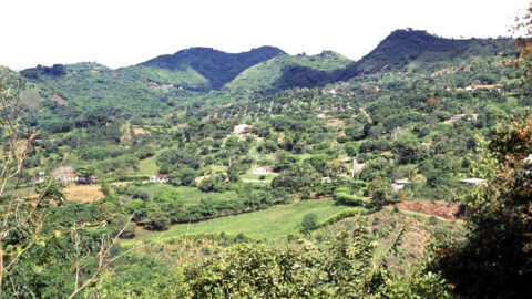
Anapoima is around 700 meters above sea level. Pictured is surrounding countryside within the Andes mountains. The capital city, Bogota lies atop of the background mountains some 2700 meters above sea level.
ALL / Explore South America / Explore Colombia / Colombia Photos / Anapoima photos / Anapoima Countryside Colombia
All original royalty-free photos, shareable maps, and informative articles.
Anapoima Countryside Colombia
Page Views
This post has been viewed 833 times
Related Articles
-
Cundinamarca Farmers near Bogota
Anapoima photos, Men, People, Portrait / Vertical
View of two farmers outside Bogota and near Anapoima in the Cundinamarca Department of Colombia.
-
Lollipop Plant
Anapoima photos, Flowers, Portrait / Vertical
Lollipop Plant or Golden Shrimp Plant (Pachystachys Lutea) native range is from El Salvador in Central America to Peru...
-
Farmland Anapoima
Anapoima photos, Landscape / Horizontal, Rural
View of surrounding farmland in Anapoima. Crops include bananas, coffee, and sugarcane. Steeper peaks of the Andes are obscured...
-
Farm in Anapoima
Anapoima photos, Landscape / Horizontal, Rural
Looking at a farm and home in the hills surrounding Anapoima. Crops grown here include coffee, sugarcane, and bananas.
-
Farmland and Andes
Anapoima photos, Landscape / Horizontal, Mountains, Rural
View of surrounding farmland in Anapoima with peaks in the Andes visible in the background. These peaks are around...
-
Farms in Anapoima
Anapoima photos, Landscape / Horizontal, Rural
Farming is an important industry in the municipality of Anapoima, Colombia. The area is known for its agricultural production,...
-
Crimson Longwing Butterfly
Anapoima photos, Butterflies, Insects, Landscape / Horizontal
The Crimson Longwing butterfly (Heliconius melpomene) is a species of butterfly that belongs to the Heliconiidae family. It is...
-
Shops in Anapoima
Anapoima photos, Landscape / Horizontal, Shops
Tourist shops in Anapoima. While Anapoima has an agricultural economy, tourism to the area has increased significantly.
0 Comments
Calendar
M | T | W | T | F | S | S |
---|---|---|---|---|---|---|
1 | 2 | 3 | 4 | 5 | 6 | |
7 | 8 | 9 | 10 | 11 | 12 | 13 |
14 | 15 | 16 | 17 | 18 | 19 | 20 |
21 | 22 | 23 | 24 | 25 | 26 | 27 |
28 | 29 | 30 |
Popular Posts
- Awakening New Zealand video (100)
- Iguazu Falls as seen from Brazil (87)
- Metrocable Medellin (78)
- Pauatahanui Inlet (69)
- Spinnaker Hill in Whitby Porirua (68)
- Spinnaker Hill View (68)
- View from Whitby (68)
- The Devil’s Throat (62)
- Aerial View of Iguazu Falls (61)
- Porirua Harbour & Papakowhai (57)
- Lake Wakatipu (57)
- Salto Rivadavia & Iguassu River (56)
- Lake Tekapo & Lupins (54)
- Nelson View (53)
- Salto Rivadavia Misiones Province (53)
- Cascadas at Iguazu (53)
Subjects
AccommodationAnimalsArchitectureBeachesBirdsBoatsBridgesBuildingsCarsChurchesCitiesCoralCultureExtra Wide HorizontalFlowersForestsHarborsHomesIslandsLakesLandscape / HorizontalMapsMenMonumentsMountainsPalmsParksPeoplePlantsPortrait / VerticalRiversRoadsRuralSeaShopsSkyscrapersSnowSunsetsTownsTrailsTransportTreesVideosVolcanicWaterfalls
Recent Comments
- Lance on Concrete Hut Wainuiomata
- Tony on Concrete Hut Wainuiomata
- DavidJ on Wellington Night Skyline
- Ben on Auckland City Skyline from Westhaven Marina in 1998
- Ben on Auckland Harbour Bridge view