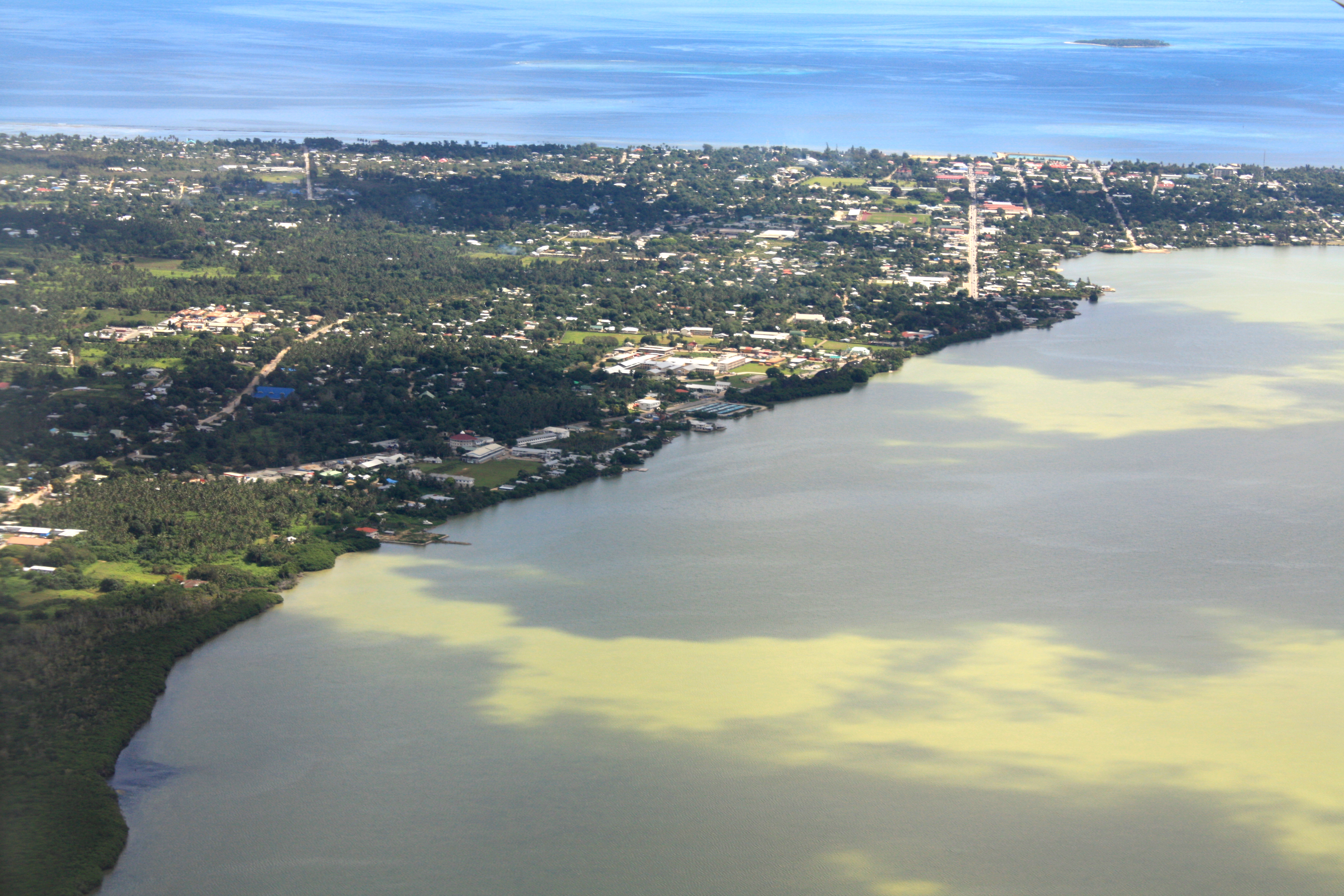
Flying into Nuku’alofa in Tonga with the coastline in view. The city is the biggest settlement in Tonga and is the capital. A small coral cay can be seen out to sea.
ALL / Explore Oceania / Explore Tonga / Tonga Photos / Nukualofa photos / Aerial View of the Nuku’alofa Coastline
All original royalty-free photos, shareable maps, and informative articles.
Aerial View of the Nuku’alofa Coastline
Page Views
This post has been viewed 1,492 times
Related Articles
-
Tapa Cloth from Tonga
Nukualofa photos, Culture, Handicrafts, Landscape / Horizontal
Tapa cloth is used for ceremonial purposes and decorating walls. The cloth is made from tree bark and is...
-
The Royal Tomb of Kuini Lavenia in Nuku’alofa
Nukualofa photos, Culture, Memorial, Portrait / Vertical
View of the royal tomb for Kuini Lavenia (Lavinia Veiongo Fotu)the first wife of King Siaosi Tupou II (King...
-
Mailetaha Plaza Nukualofa Tonga
Nukualofa photos, Landscape / Horizontal, Shops, Towns
View of Mailetaha Plaza, on the corner of Hihifo Road and Taufa’ahau Road in Nuku’alofa, Tonga. The plaza has...
-
Tongans in their Sunday best for church
Nukualofa photos, Clothing, Culture, Landscape / Horizontal, People
Every Sunday, Tongans attend church services. They dress up as a sign of respect for God and their faith...
-
Rural Landscape near Nuku’alofa
Nukualofa photos, Harbors, Portrait / Vertical, Roads, Rural, Sea
Aerial view of palm plantations directly outside the capital, Nuku’alofa.
-
Flash flood in Nuku’alofa Tonga
Nukualofa photos, Landscape / Horizontal, Roads, Towns, Weather
With Tonga’s location in the tropics, it is subject to tropical downpours. Pictured is a flash flood in Nuku’alofa...
-
Faua Harbour in Nuku’alofa Tonga
Nukualofa photos, Boats, Harbors, Landscape / Horizontal, Sea
View of Faua Harbour in Nuku’alofa on the main island of Tongatapu. Pictured are two boats with one named...
-
Nuku’alofa coastline and beach
Nukualofa photos, Beaches, Landscape / Horizontal, Palms, Sea
Looking at the coast and a small beach in the town of Nuku’alofa. The town is located on the...
0 Comments
Calendar
M | T | W | T | F | S | S |
---|---|---|---|---|---|---|
1 | 2 | |||||
3 | 4 | 5 | 6 | 7 | 8 | 9 |
10 | 11 | 12 | 13 | 14 | 15 | 16 |
17 | 18 | 19 | 20 | 21 | 22 | 23 |
24 | 25 | 26 | 27 | 28 |
Popular Posts
- Awakening New Zealand video (100)
- Iguazu Falls as seen from Brazil (87)
- Metrocable Medellin (78)
- Pauatahanui Inlet (69)
- Spinnaker Hill in Whitby Porirua (68)
- Spinnaker Hill View (68)
- View from Whitby (68)
- The Devil’s Throat (62)
- Aerial View of Iguazu Falls (61)
- Porirua Harbour & Papakowhai (57)
- Lake Wakatipu (57)
- Salto Rivadavia & Iguassu River (56)
- Lake Tekapo & Lupins (54)
- Nelson View (53)
- Salto Rivadavia Misiones Province (53)
- Cascadas at Iguazu (53)
Subjects
AccommodationAnimalsArchitectureBeachesBirdsBoatsBridgesBuildingsCarsChurchesCitiesCoralCultureExtra Wide HorizontalFlowersForestsHarborsHomesIslandsLakesLandscape / HorizontalMapsMenMonumentsMountainsPalmsParksPeoplePlantsPortrait / VerticalRiversRoadsRuralSeaShopsSkyscrapersSnowSunsetsTownsTrailsTransportTreesVideosVolcanicWaterfalls
Recent Comments
- Lance on Concrete Hut Wainuiomata
- Tony on Concrete Hut Wainuiomata
- DavidJ on Wellington Night Skyline
- Ben on Auckland City Skyline from Westhaven Marina in 1998
- Ben on Auckland Harbour Bridge view