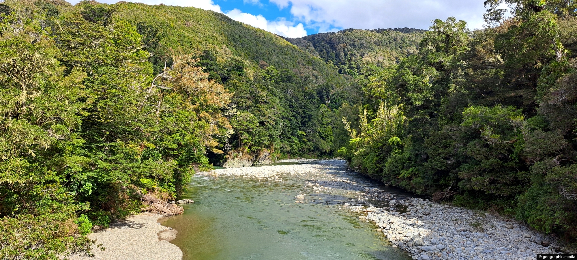
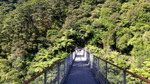
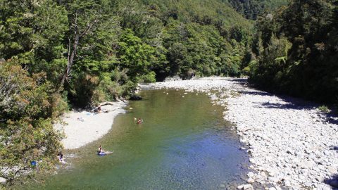
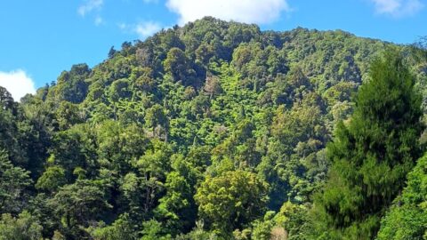
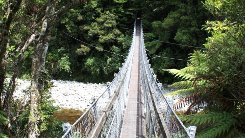
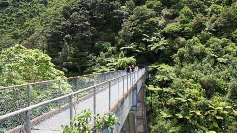
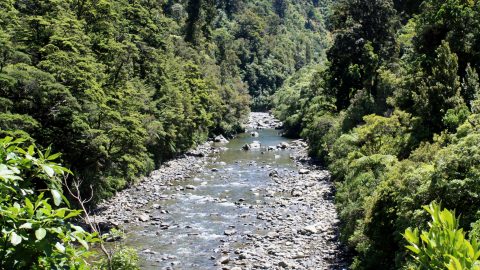
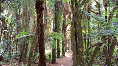
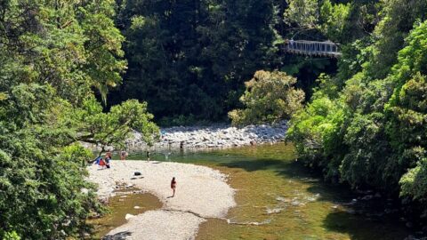
The Hutt River runs through Kaitoke Regional Park and is a major feature of the reserve. The river is a popular spot for swimming and there are several walking tracks along its banks that offer scenic views of the water and the surrounding forest.
ALL / Explore Oceania / Explore New Zealand / New Zealand Photos / Kaitoke photos / Hutt River Kaitoke Regional Park
All original royalty-free photos, shareable maps, and informative articles.
Hutt River Kaitoke Regional Park
Page Views
This post has been viewed 428 times
Related Articles
-
Hutt River Gorge
Kaitoke photos, Landscape / Horizontal, Rivers
View of Hutt River Gorge in Kaitoke Regional Park in the Wellington region. The river has excellent natural pools that...
-
Bridge Over The Hutt River
Kaitoke photos, Bridges, Forests, Landscape / Horizontal
View of a walking bridge over the Hutt River in Kaitoke Regional Park. This bridge forms part of a...
-
Podocarp Rainforest Walk
Kaitoke photos, Forests, Landscape / Horizontal, Trees
View of a circuit walk through a Podocarp rainforest in Kaitoke Regional Park. Podocarp trees are found in the...
-
Giant Rata Tree in Kaitoke Regional Park
Kaitoke photos, Portrait / Vertical, Trees
This giant Rata tree rises out of the canopy of a podocarp rainforest. The location is Kaitoke Regional Park...
-
Flume Bridge in Kaitoke Regional Park
Kaitoke photos, Bridges, Forests, Landscape / Horizontal
Flume Bridge in Kaitoke Regional Park is part of a circuit walk. This bridge crosses the Hutt River and...
-
Rainforest Canopy
Kaitoke photos, Ferns, Forests, Landscape / Horizontal
Looking up toward the canopy of the rainforest in Kaitoke Regional Park. The park is famous for its forest...
-
Pākuratahi River & Hutt River
Kaitoke photos, Forests, People, Portrait / Vertical, Rivers
View of the Pākuratahi River flowing into the Hutt River. This location and surrounds are significant locations in New...
-
Swimming at Kaitoke Regional Park
Kaitoke photos, Forests, Landscape / Horizontal, Rivers
Two rivers flow through the park, the Hutt River and Pakuratahi River. Both rivers offer a number of swimming...
0 Comments
Calendar
M | T | W | T | F | S | S |
---|---|---|---|---|---|---|
1 | 2 | |||||
3 | 4 | 5 | 6 | 7 | 8 | 9 |
10 | 11 | 12 | 13 | 14 | 15 | 16 |
17 | 18 | 19 | 20 | 21 | 22 | 23 |
24 | 25 | 26 | 27 | 28 |
Popular Posts
- Awakening New Zealand video (100)
- Iguazu Falls as seen from Brazil (87)
- Metrocable Medellin (78)
- Pauatahanui Inlet (69)
- Spinnaker Hill in Whitby Porirua (68)
- Spinnaker Hill View (68)
- View from Whitby (68)
- The Devil’s Throat (62)
- Aerial View of Iguazu Falls (61)
- Porirua Harbour & Papakowhai (57)
- Lake Wakatipu (57)
- Salto Rivadavia & Iguassu River (56)
- Lake Tekapo & Lupins (54)
- Nelson View (53)
- Salto Rivadavia Misiones Province (53)
- Cascadas at Iguazu (53)
Subjects
AccommodationAnimalsArchitectureBeachesBirdsBoatsBridgesBuildingsCarsChurchesCitiesCoralCultureExtra Wide HorizontalFlowersForestsHarborsHomesIslandsLakesLandscape / HorizontalMapsMenMonumentsMountainsPalmsParksPeoplePlantsPortrait / VerticalRiversRoadsRuralSeaShopsSkyscrapersSnowSunsetsTownsTrailsTransportTreesVideosVolcanicWaterfalls
Recent Comments
- Lance on Concrete Hut Wainuiomata
- Tony on Concrete Hut Wainuiomata
- DavidJ on Wellington Night Skyline
- Ben on Auckland City Skyline from Westhaven Marina in 1998
- Ben on Auckland Harbour Bridge view