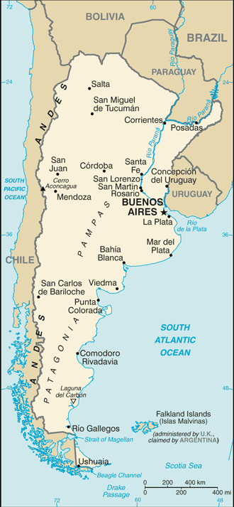
A basic map of Argentina showing main cities and towns as well as surrounding countries.
Argentina Maps
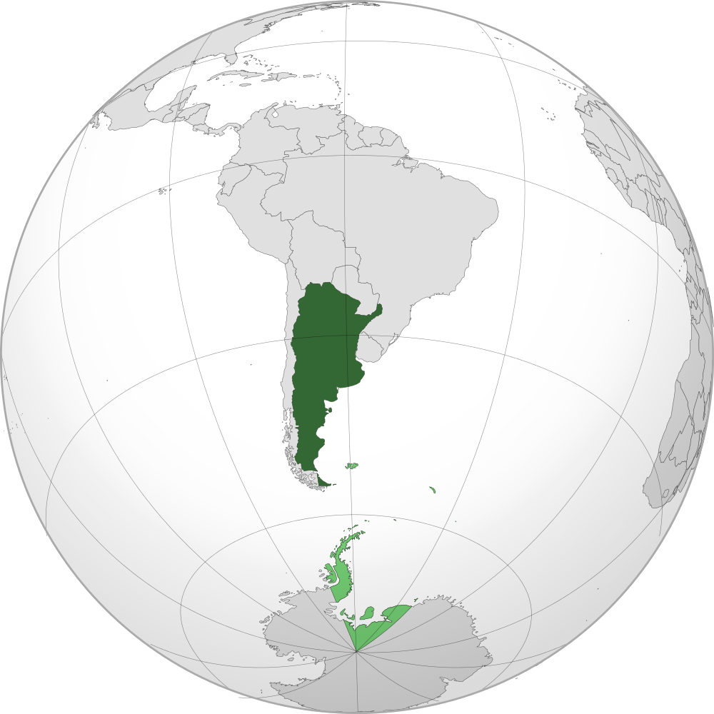
Projection of Argentina on the globe and in a South American context. It is the second largest country after...
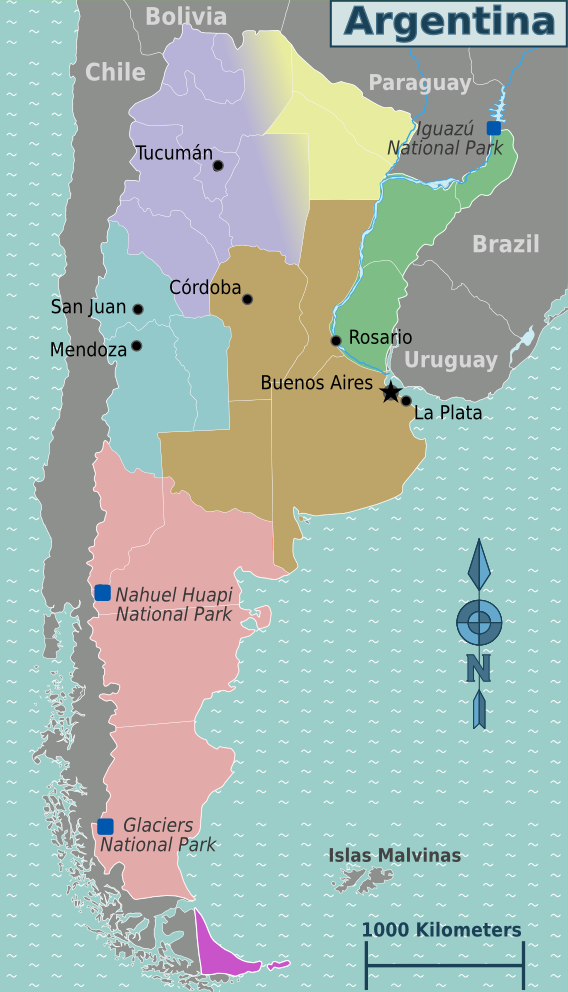
Argentina has seven regions. The regions are as follows: Andean Northwest, Chaco, Cuyo, Mesopotamia, Pampas, Patagonia, and Tierra del...
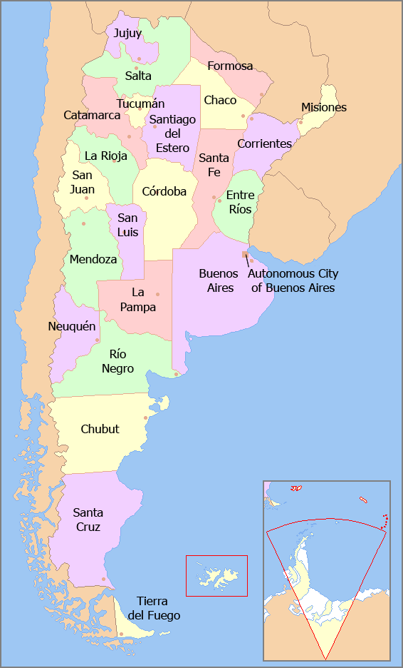
Argentina is made up of 23 provinces and one autonomous city, Buenos Aires, the capital city. Each province and...
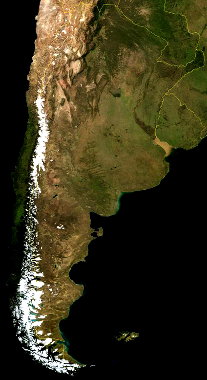
A satellite view of Argentina in South America. The Andes can be clearly seen because of snow.
Popular Posts
- Awakening New Zealand video (100)
- Iguazu Falls as seen from Brazil (87)
- Metrocable Medellin (78)
- Spinnaker Hill in Whitby Porirua (69)
- Pauatahanui Inlet (69)
- View from Whitby (68)
- Spinnaker Hill View (68)
- The Devil’s Throat (63)
- Aerial View of Iguazu Falls (61)
- Porirua Harbour & Papakowhai (58)
- Lake Wakatipu (57)
- Salto Rivadavia & Iguassu River (56)
- Close up of Salto Rivadavia (54)
- Salto Rivadavia Misiones Province (54)
- Lake Tekapo & Lupins (54)
- Nelson View (53)
Subjects
AccommodationAnimalsArchitectureBeachesBirdsBoatsBridgesBuildingsCarsChurchesCitiesCoralCultureExtra Wide HorizontalFlowersForestsHarborsHomesIslandsLakesLandscape / HorizontalMapsMenMonumentsMountainsPalmsParksPeoplePlantsPortrait / VerticalRiversRoadsRuralSeaShopsSkyscrapersSnowSunsetsTownsTrailsTransportTreesVideosVolcanicWaterfalls


Recent Comments