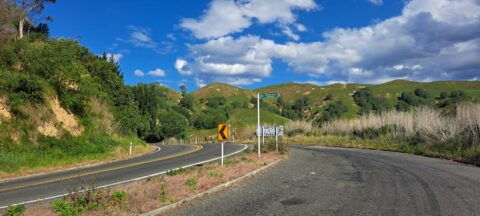
Mount Erin Lookout, located along Waimarama Road near Havelock North in Hawke’s Bay, offers stunning vistas of the surrounding...
Te Mata Peak
About Te Mata Peak
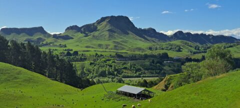
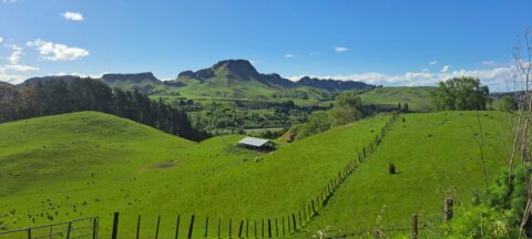
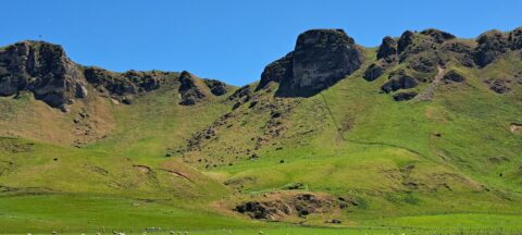
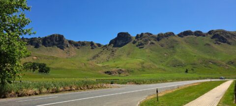
Photos of Te Mata Peak and surrounding landscape in the Hawkes Bat Region.
Te Mata Peak is an iconic natural landmark in Hawke’s Bay, New Zealand, located near Havelock North. Rising to 399 metres, it offers stunning panoramic views of the surrounding region, including the patchwork plains, coastline, and distant mountain ranges. On clear days, visitors can see as far as Mount Ruapehu, making it a favourite spot for locals and tourists alike.
Te Mata Park, which encompasses the peak, offers a variety of outdoor activities. Visitors can explore walking and cycling trails that wind through native bush, limestone formations, and open landscapes. For those seeking adventure, the peak is also popular for mountain biking and paragliding, providing unique ways to enjoy the spectacular surroundings.
The park is home to diverse plant and birdlife, with native species thriving in the regenerating bush. Efforts to preserve and protect this environment ensure its natural beauty remains intact for future generations. A drive or hike to the summit rewards visitors with breathtaking views, and the area is equipped with picnic spots and interpretive displays.
Close to the vibrant town of Havelock North, Te Mata Peak is easily accessible and often combined with visits to nearby wineries such as Craggy Range and Black Barn. These attractions, along with the peak’s natural and cultural appeal, make it a highlight of any Hawke’s Bay itinerary.
For older photos of Te Mata Peak, see Virtual New Zealand.
From the Mount Erin Lookout, located just outside Havelock North along Waimārama Road, you can enjoy spectacular views of...
A view of lush farmland surrounds Te Mata Peak in Hawke’s Bay, New Zealand. Renowned for its fertile land,...
Waimarama Road and Te Mata Peak are closely connected as part of the stunning landscape of Hawke’s Bay, New...
Te Mata Peak stands at 399 metres (1,309 feet), offering sweeping views of Hawke’s Bay. From its summit, visitors...
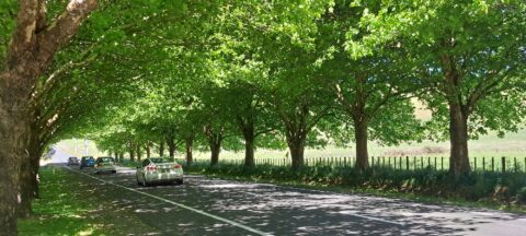
Waimarama Road itself is a scenic drive that passes through rolling farmland, orchards, and vineyards, showcasing the agricultural richness...
Calendar
| M | T | W | T | F | S | S |
|---|---|---|---|---|---|---|
| 1 | ||||||
| 2 | 3 | 4 | 5 | 6 | 7 | 8 |
| 9 | 10 | 11 | 12 | 13 | 14 | 15 |
| 16 | 17 | 18 | 19 | 20 | 21 | 22 |
| 23 | 24 | 25 | 26 | 27 | 28 | 29 |
| 30 | ||||||
Popular Posts
- Awakening New Zealand video (100)
- Iguazu Falls as seen from Brazil (87)
- Metrocable Medellin (78)
- Pauatahanui Inlet (69)
- Spinnaker Hill in Whitby Porirua (68)
- Spinnaker Hill View (68)
- View from Whitby (68)
- The Devil’s Throat (62)
- Aerial View of Iguazu Falls (61)
- Porirua Harbour & Papakowhai (57)
- Lake Wakatipu (57)
- Salto Rivadavia & Iguassu River (56)
- Lake Tekapo & Lupins (54)
- Nelson View (53)
- Salto Rivadavia Misiones Province (53)
- Cascadas at Iguazu (53)

Recent Comments