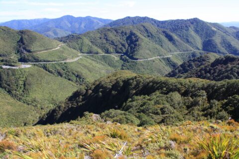
View of the Remutaka Hill Road as seen from the Tararua range. This road separates the Tararua range from...
Tararua Range photos
About The Tararua Ranges
Photos of the Tararua Range in the Wellington region
The Tararua Range is a mountain range located in the southern part of New Zealand’s North Island. It extends for approximately 80 kilometers northeast of Wellington city. The range is known for its rugged terrain and challenging hiking trails, which attract many outdoor enthusiasts.
The Tararua Range is part of the larger Tararua Forest Park, which covers over 100,000 hectares and is home to a diverse range of flora and fauna. The range is characterized by steep ridges, deep gorges, and a series of peaks that rise to over 1,500 meters. South of the range lies the Remutaka range and north is the Ruahine range.
There are many hiking trails throughout the Tararua Range, from easy day hikes to multi-day treks that require a high level of fitness and experience. The most popular trails include the Southern Crossing, a three-day hike that traverses the range from Kaitoke to Otaki Forks, and the Holdsworth-Jumbo Circuit, a four-day hike that takes in some of the range’s most spectacular scenery.
For more photos of the Tararua Range, visit Virtual New Zealand.
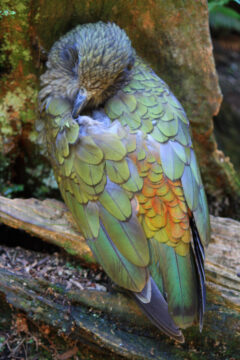
Close up view in Staglands Wildlife Reserve of a resting kea showing his stunning plumage. Underneath the bird has...
Calendar
| M | T | W | T | F | S | S |
|---|---|---|---|---|---|---|
| 1 | ||||||
| 2 | 3 | 4 | 5 | 6 | 7 | 8 |
| 9 | 10 | 11 | 12 | 13 | 14 | 15 |
| 16 | 17 | 18 | 19 | 20 | 21 | 22 |
| 23 | 24 | 25 | 26 | 27 | 28 | 29 |
| 30 | ||||||
Popular Posts
- Awakening New Zealand video (100)
- Iguazu Falls as seen from Brazil (87)
- Metrocable Medellin (78)
- Pauatahanui Inlet (69)
- Spinnaker Hill in Whitby Porirua (68)
- Spinnaker Hill View (68)
- View from Whitby (68)
- The Devil’s Throat (62)
- Aerial View of Iguazu Falls (61)
- Porirua Harbour & Papakowhai (57)
- Lake Wakatipu (57)
- Salto Rivadavia & Iguassu River (56)
- Lake Tekapo & Lupins (54)
- Nelson View (53)
- Salto Rivadavia Misiones Province (53)
- Cascadas at Iguazu (53)


Recent Comments