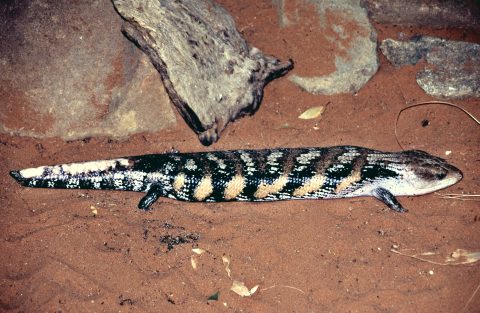
All but one species of Blue-tongued skinks are endemic to Australia. They are found in wide range of climatic...
All original royalty-free photos, shareable maps, and informative articles.
Uluru-Kata Tjuta National Park photos
About Uluru-Kata Tjuta National Park
View photos of Uluru-Kata Tjuta National Park in Australia’s Northern Territory.
Uluru-Kata Tjuta National Park is a remarkable natural and cultural heritage site located in the heart of Australia’s Red Centre. Encompassing the iconic Uluru (Ayers Rock) and the breathtaking Kata Tjuta (The Olgas), the park spans over 1,325 square kilometers (512 square miles) of diverse landscapes.
The park is known for its rich Aboriginal cultural significance. The Indigenous Anangu people have lived on this land for thousands of years and consider it a deeply sacred place.
Most tourists visit the park to see the three awe-inspiring rock formations that
Visitors to the park can explore a range of walking trails, witness stunning sunrises and sunsets over Uluru and Kata Tjuta, and learn about the rich Aboriginal culture and history through guided tours and cultural experiences.
The park is famous for its three giant rocks or monoliths. These three rock formations contribute to the unique and awe-inspiring beauty of Uluru-Kata Tjuta National Park, attracting visitors from around the world.
Uluru (Ayers Rock) is the most famous and prominent rock formation in the national park. It is a massive sandstone monolith that rises approximately 340 meters (1,110 feet) above the surrounding desert. It is known for its distinctive red color and its changing hues throughout the day, particularly during sunrise and sunset.
Kata Tjuta (The Olgas) is also a popular attraction. It is a group of 36 domed rock formations located about 50 kilometers (31 miles) west of Uluru. These impressive geological formations, composed of conglomerate rock, create a stunning and dramatic landscape. The tallest peak within Kata Tjuta is Mount Olga, which stands at around 546 meters (1,791 feet).
Mount Conner (Attila) is not as well-known as Uluru and Kata Tjuta, but it is another prominent rock formation within the national park. It is often referred to as “Fool-uru” due to its resemblance to Uluru. Visitors often think it is Kata Tjuta as it is usually the first monolith they see when entering the park. Mount Conner stands at an impressive height of around 300 meters (984 feet) and offers captivating views across the surrounding plains.
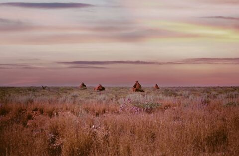
View of termite mounds (ant hills) found in Australia’s Red Centre. The term “Red Centre” designates the central geographical...
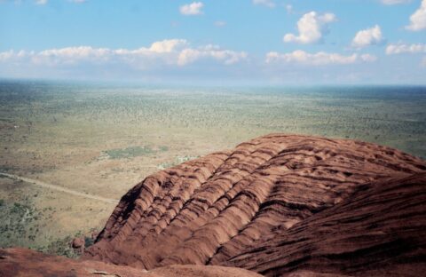
Ascending Ayers Rock in 1988. Before 2017, you could ascend Ayers Rock (Uluru). There was a trail that included...
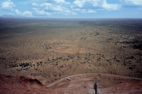
Looking down onto the desert plains below from atop Uluru in the Northern Territory, (circa 1988). Uluru is a...
Calendar
| M | T | W | T | F | S | S |
|---|---|---|---|---|---|---|
| 1 | ||||||
| 2 | 3 | 4 | 5 | 6 | 7 | 8 |
| 9 | 10 | 11 | 12 | 13 | 14 | 15 |
| 16 | 17 | 18 | 19 | 20 | 21 | 22 |
| 23 | 24 | 25 | 26 | 27 | 28 | 29 |
| 30 | ||||||
Popular Posts
- Awakening New Zealand video (100)
- Iguazu Falls as seen from Brazil (87)
- Metrocable Medellin (78)
- Pauatahanui Inlet (69)
- Spinnaker Hill in Whitby Porirua (68)
- Spinnaker Hill View (68)
- View from Whitby (68)
- The Devil’s Throat (62)
- Aerial View of Iguazu Falls (61)
- Porirua Harbour & Papakowhai (57)
- Lake Wakatipu (57)
- Salto Rivadavia & Iguassu River (56)
- Lake Tekapo & Lupins (54)
- Nelson View (53)
- Salto Rivadavia Misiones Province (53)
- Cascadas at Iguazu (53)


Recent Comments