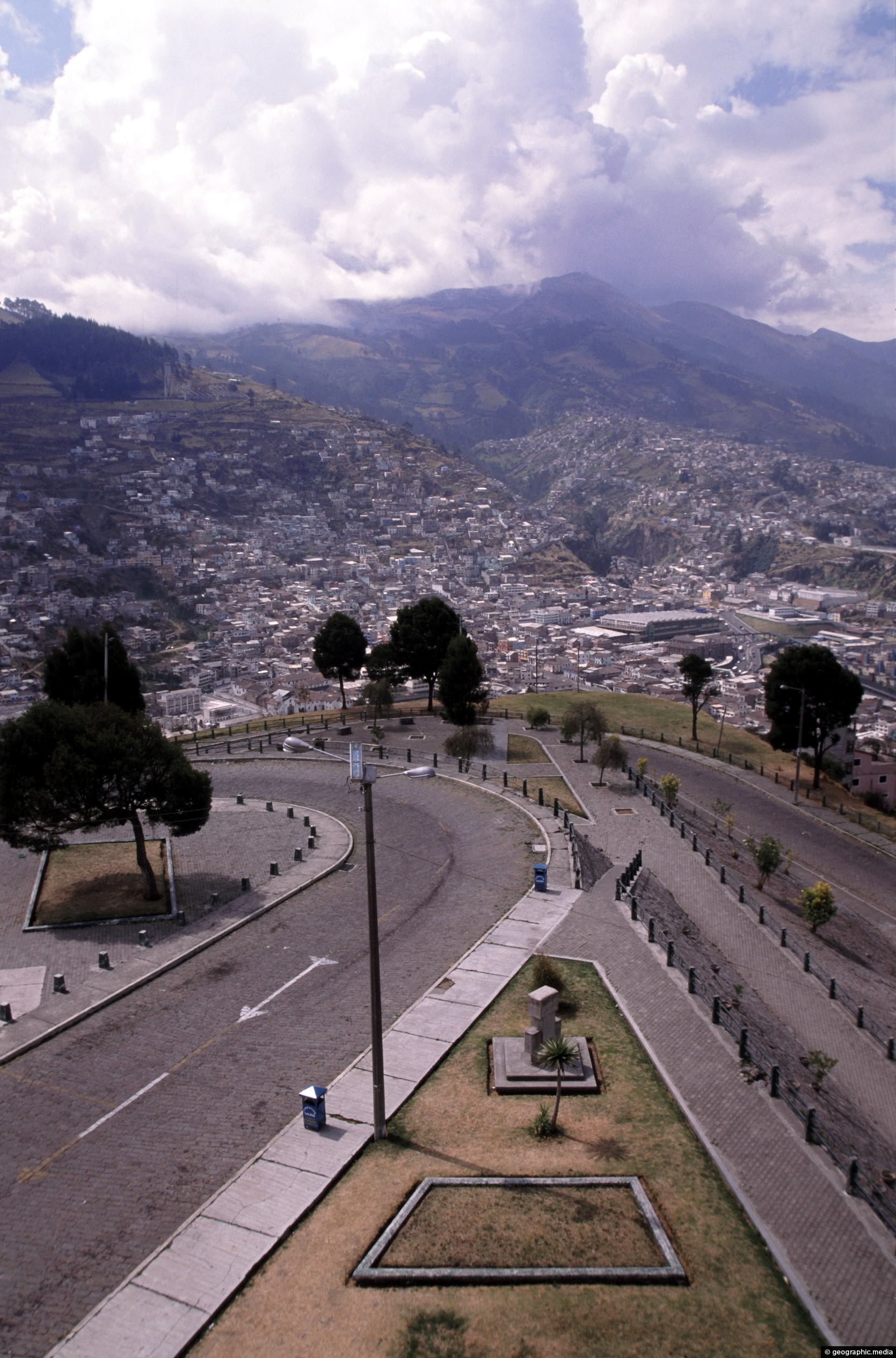
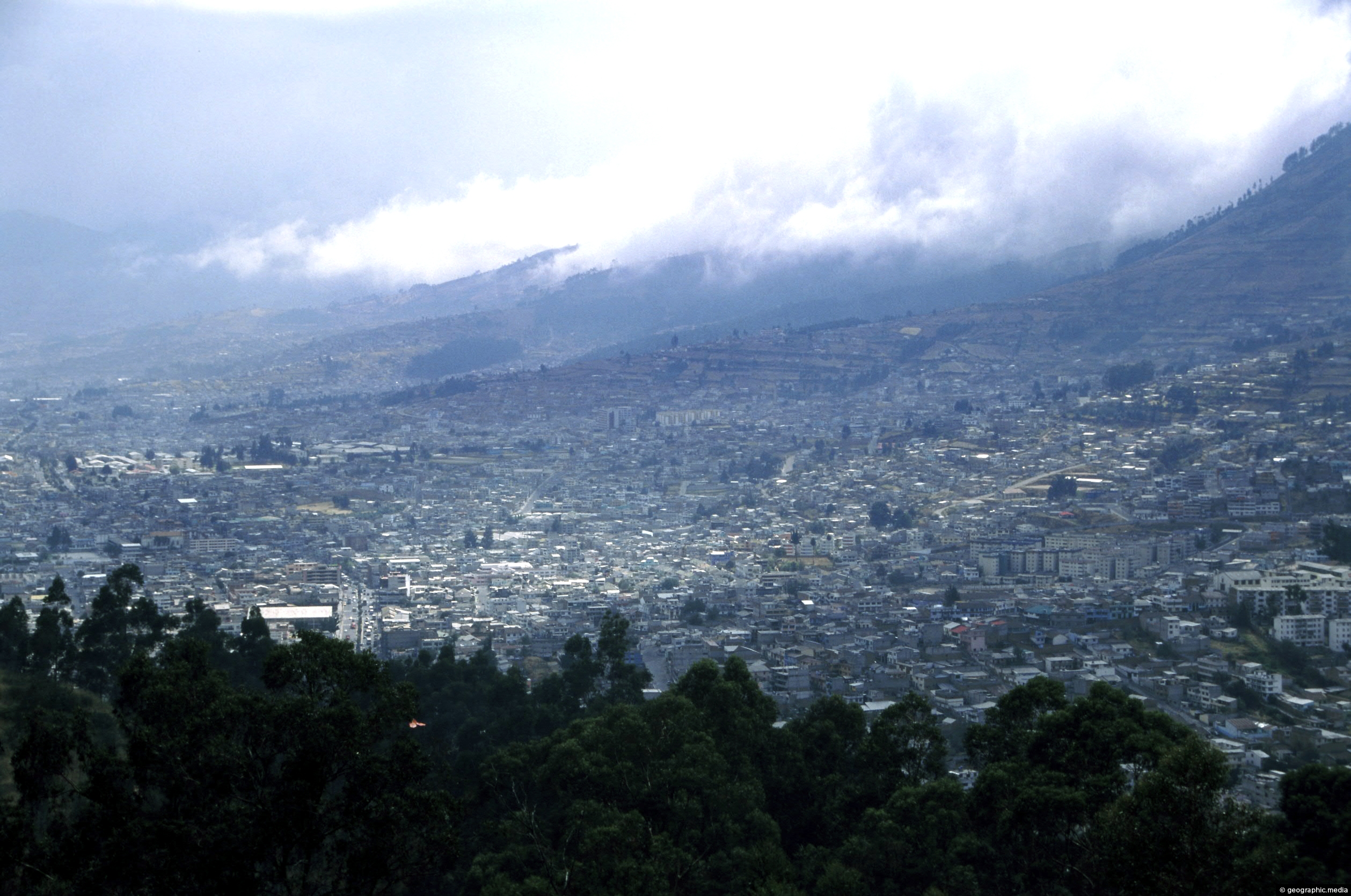
View of a road that descends down from El Panecillo Hill toward central Quito. At the bottom is the colonial part of Quito.
ALL / Explore South America / Explore Ecuador / Ecuador Photos / Quito photos / Road to El Panecillo in Quito Ecuador
All original royalty-free photos, shareable maps, and informative articles.
Road to El Panecillo in Quito Ecuador
Page Views
This post has been viewed 2,891 times
Related Articles
-
Quito Architecture in Ecuador
Quito photos, Buildings, Cities, Homes, Portrait / Vertical, Roads
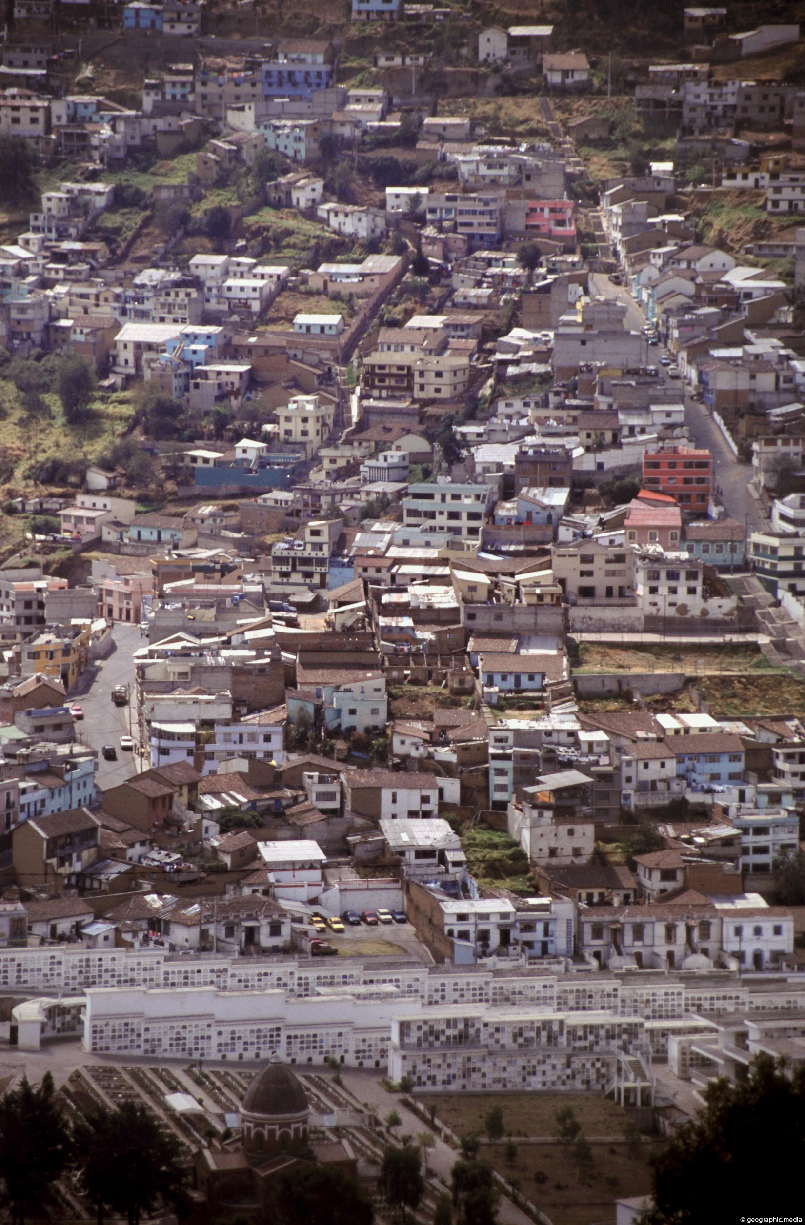
Zooming in on apartments and homes in the city of Quito. In view is a small section located at...
-
Metropolitan Park & Quito in Ecuador
Quito photos, Cities, Landscape / Horizontal, Parks
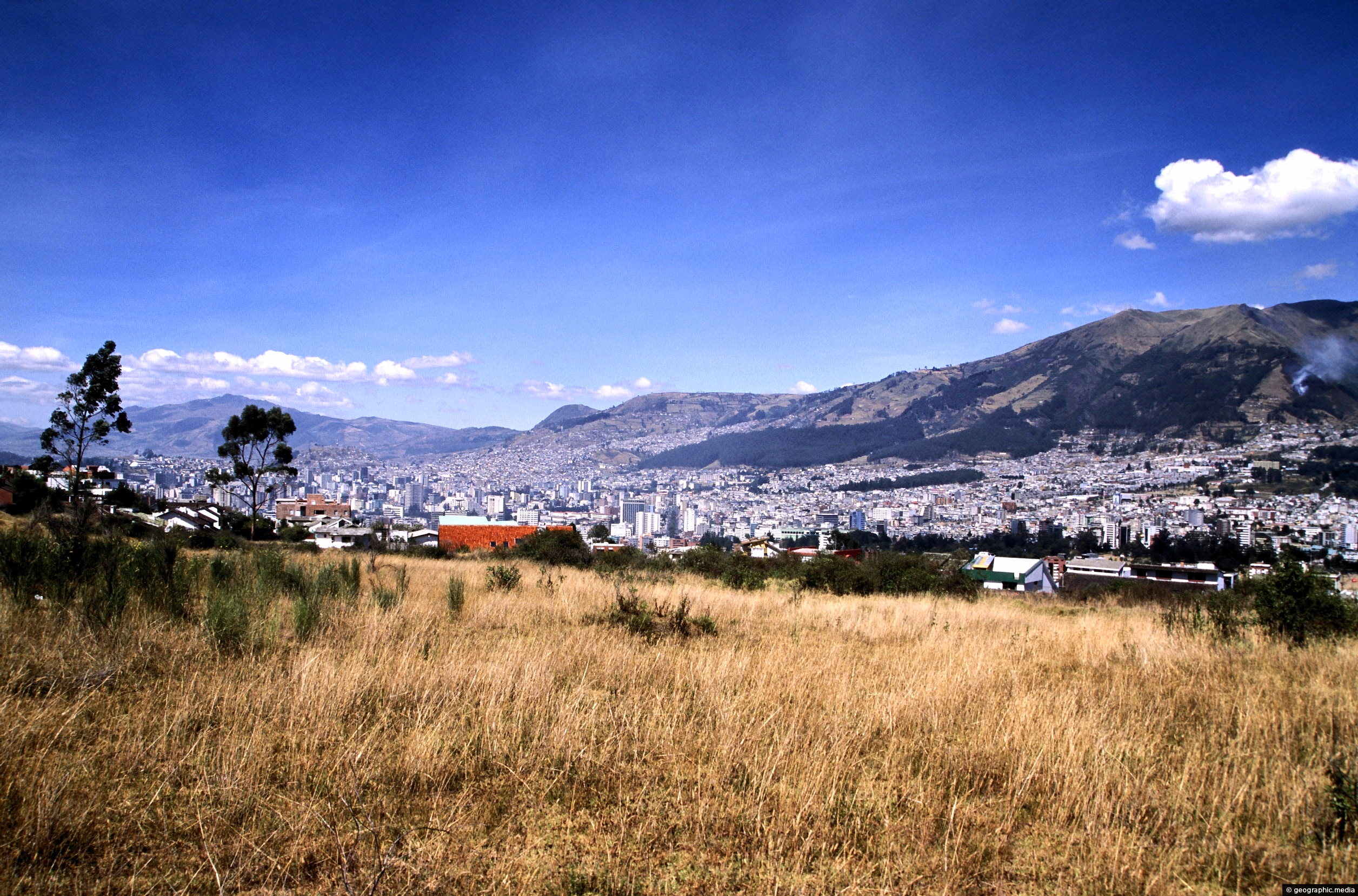
View from the edge of Guanguiltagua Metropolitan Park in the east looking south toward central Quito. The western hills...
-
Quito & Park
Quito photos, Cities, Landscape / Horizontal
Quito as seen from 3000 metres above sea level at Guanguiltagua Metropolitan Park.
-
View of Cotopaxi Volcano in Ecuador
Quito photos, Landscape / Horizontal, Mountains, Volcanic
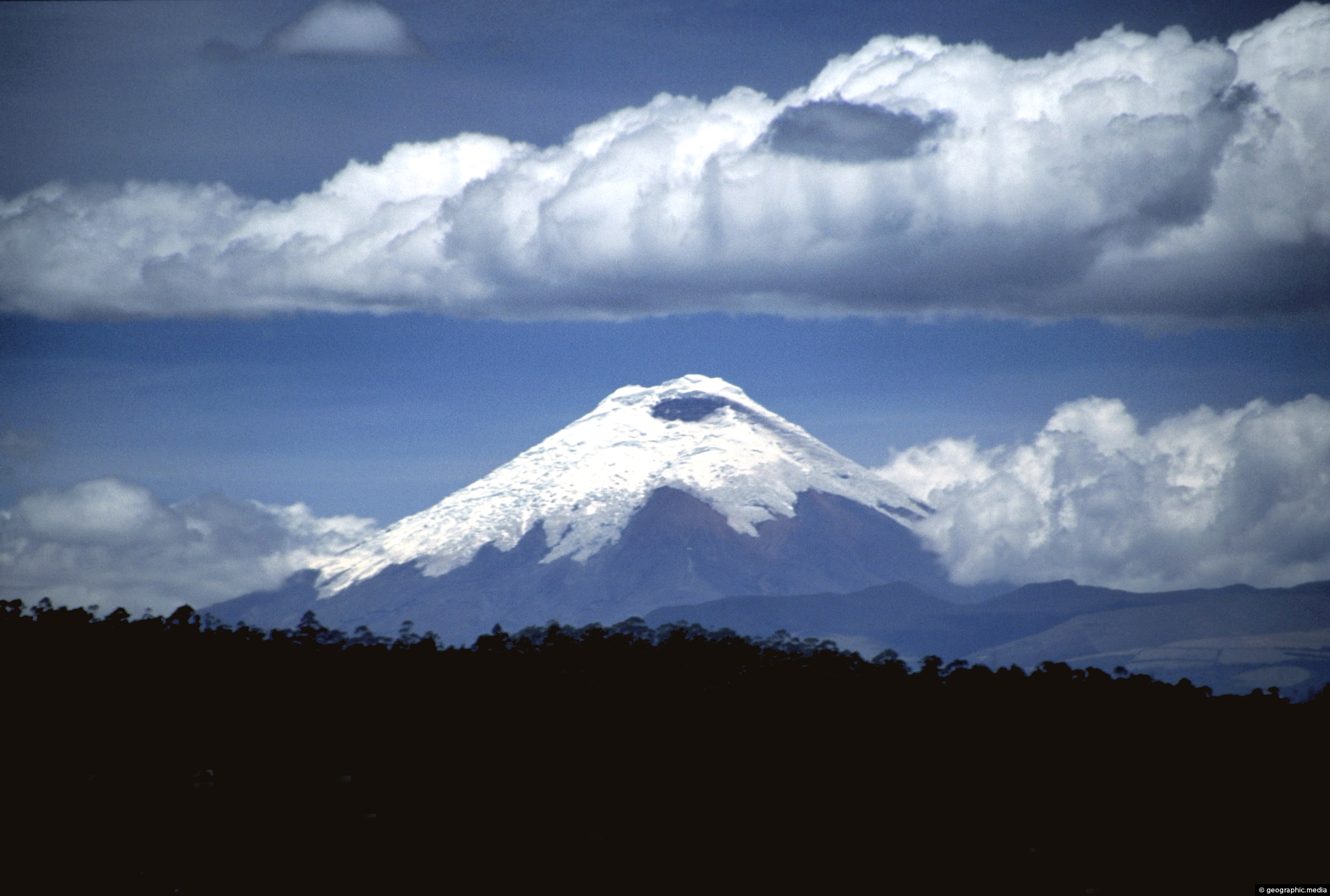
View of Cotopaxi Volcano located in the Andes mountains. This stratovolcano reaches a height of 5,897 metres, making it...
-
La Virgen de Quito in Ecuador
Quito photos, Monuments, Portrait / Vertical
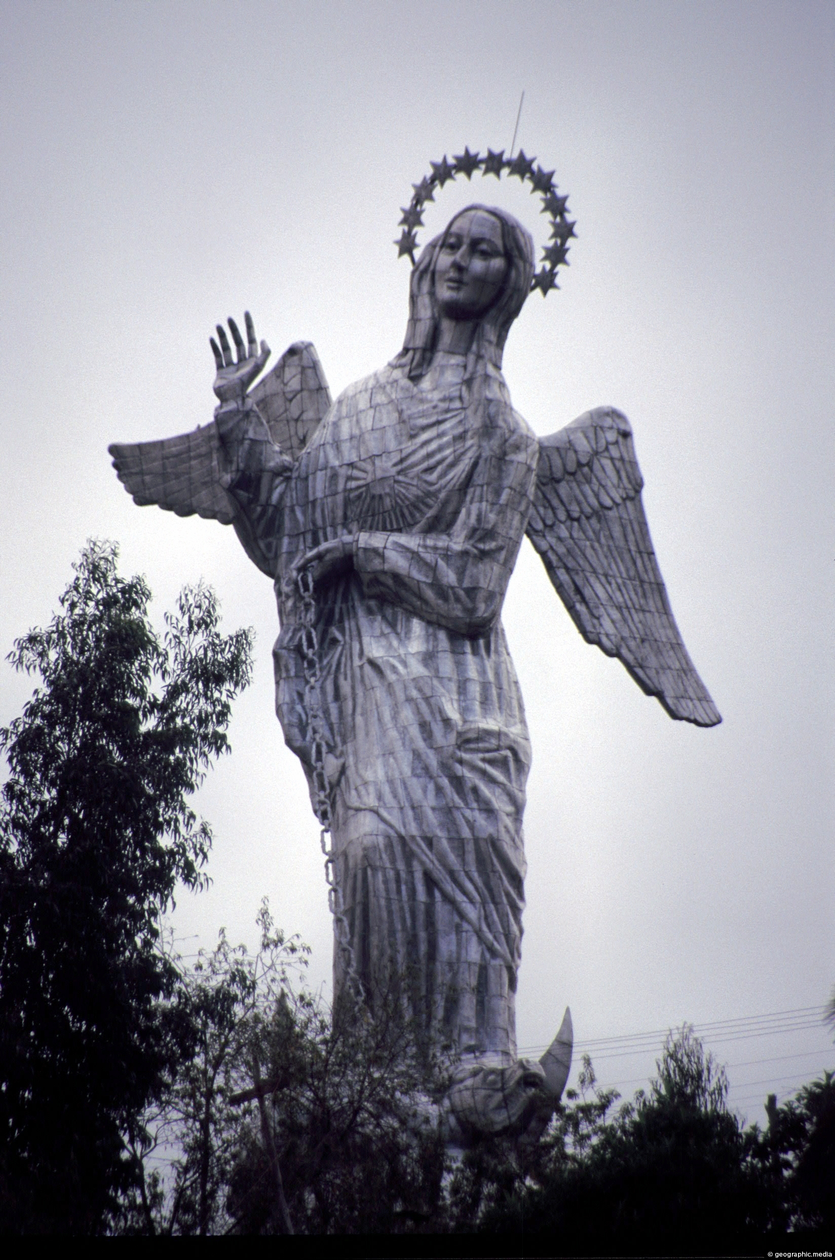
On top of the 200 metre high volcanic hill known as El Panecillo stands ‘La Virgen de Quito’. This...
-
Pululahua Volcano Quito
Quito photos, Landscape / Horizontal, Mountains, Rural, Volcanic
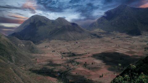
Pululahua is actually a volcanic caldera. It is located near Quito, the capital city of Ecuador. The word “Pululahua”...
-
Pichincha Volcano in Quito Ecuador
Quito photos, Cities, Landscape / Horizontal, Volcanic
View at the foot of Pichincha Volcano where some of Quito’s suburbs wrap around its eastern slopes. Pichincha is...
-
View of Quito from Calle Guanguiltagua
Quito photos, Buildings, Cities, Landscape / Horizontal, Skyscrapers
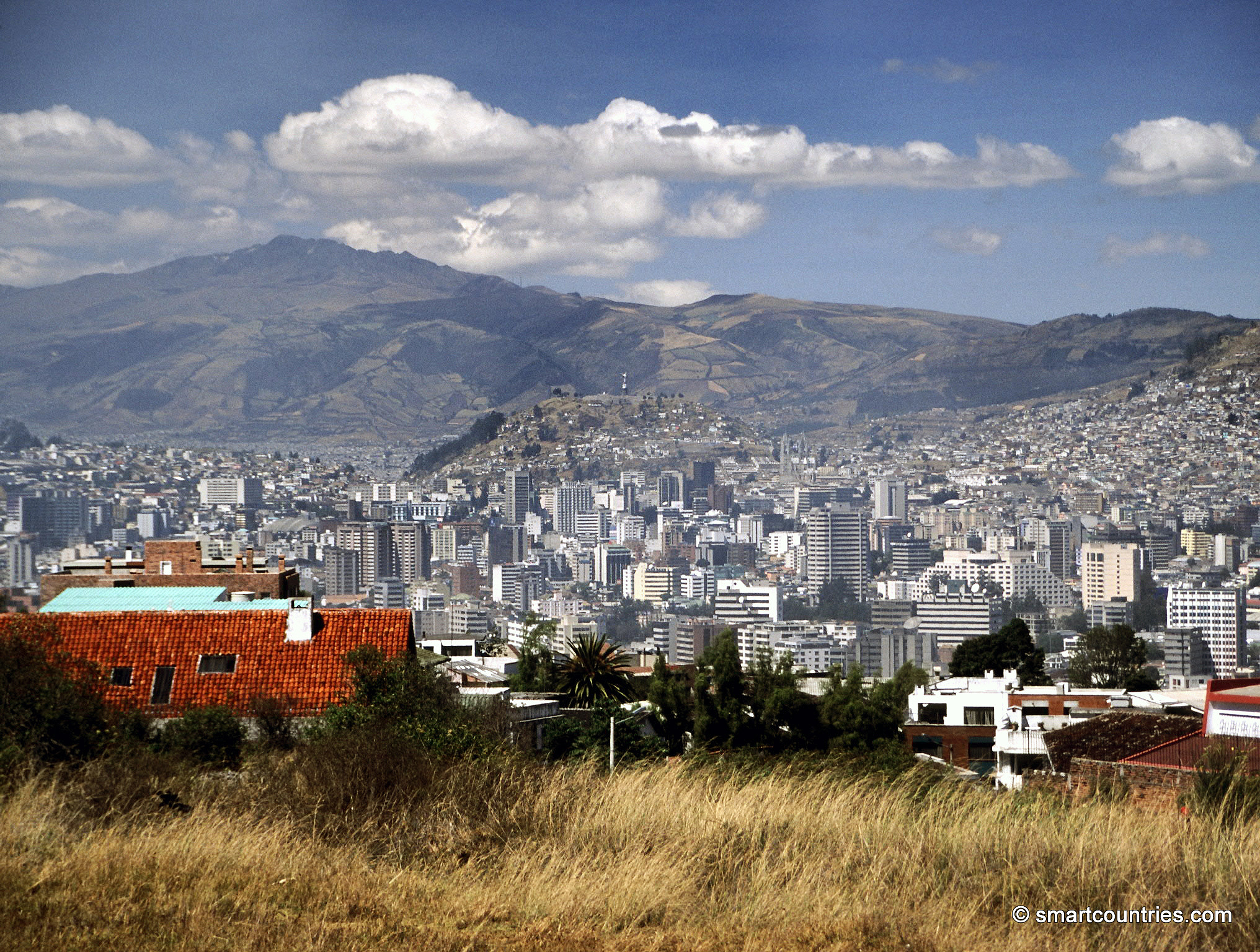
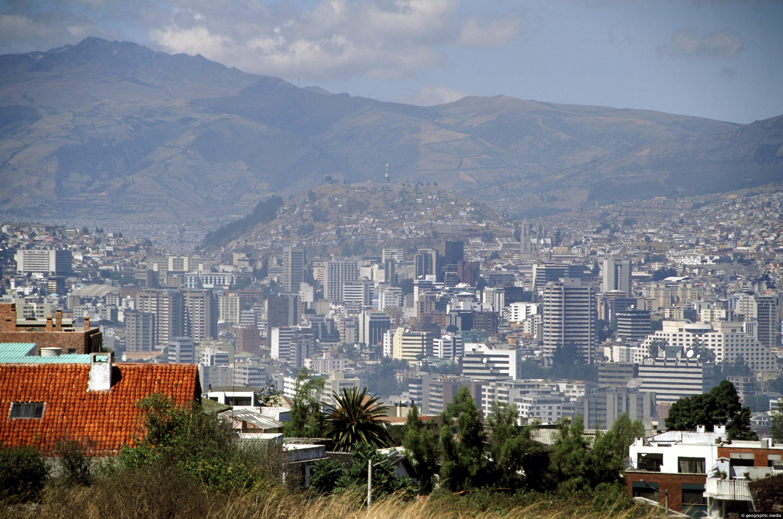
View of Quito’s central business district as seen from Calle Guanguiltagua (Guanguiltagua Street). La Virgen de Quito can be...
0 Comments
Latest Posts
Popular Posts
- Awakening New Zealand video (100)
- Iguazu Falls as seen from Brazil (86)
- Metrocable Medellin (77)
- Spinnaker Hill View (68)
- Pauatahanui Inlet (68)
- View from Whitby (68)
- Spinnaker Hill in Whitby Porirua (67)
- The Devil’s Throat (62)
- Aerial View of Iguazu Falls (61)
- Porirua Harbour & Papakowhai (57)
- Lake Wakatipu (57)
- Salto Rivadavia & Iguassu River (56)
- Lake Tekapo & Lupins (54)
- Cascadas at Iguazu (53)
- Close up of Salto Rivadavia (53)
- Salto Rivadavia Misiones Province (53)
Subjects
AccommodationAnimalsArchitectureBeachesBirdsBoatsBridgesBuildingsCarsChurchesCitiesCliffsCoralCultureExtra Wide HorizontalFlowersForestsHarborsHomesIslandsLakesLandscape / HorizontalMapsMenMonumentsMountainsPalmsParksPeoplePlantsPortrait / VerticalRiversRoadsRuralSeaShopsSkyscrapersSnowSunsetsTownsTransportTreesVideosVolcanicWaterfalls
Recent Comments
- Lance on Concrete Hut Wainuiomata
- DavidJ on Concrete Hut Wainuiomata
- Tony on Concrete Hut Wainuiomata
- DavidJ on Wellington Night Skyline
- Ben on Auckland City Skyline from Westhaven Marina in 1998