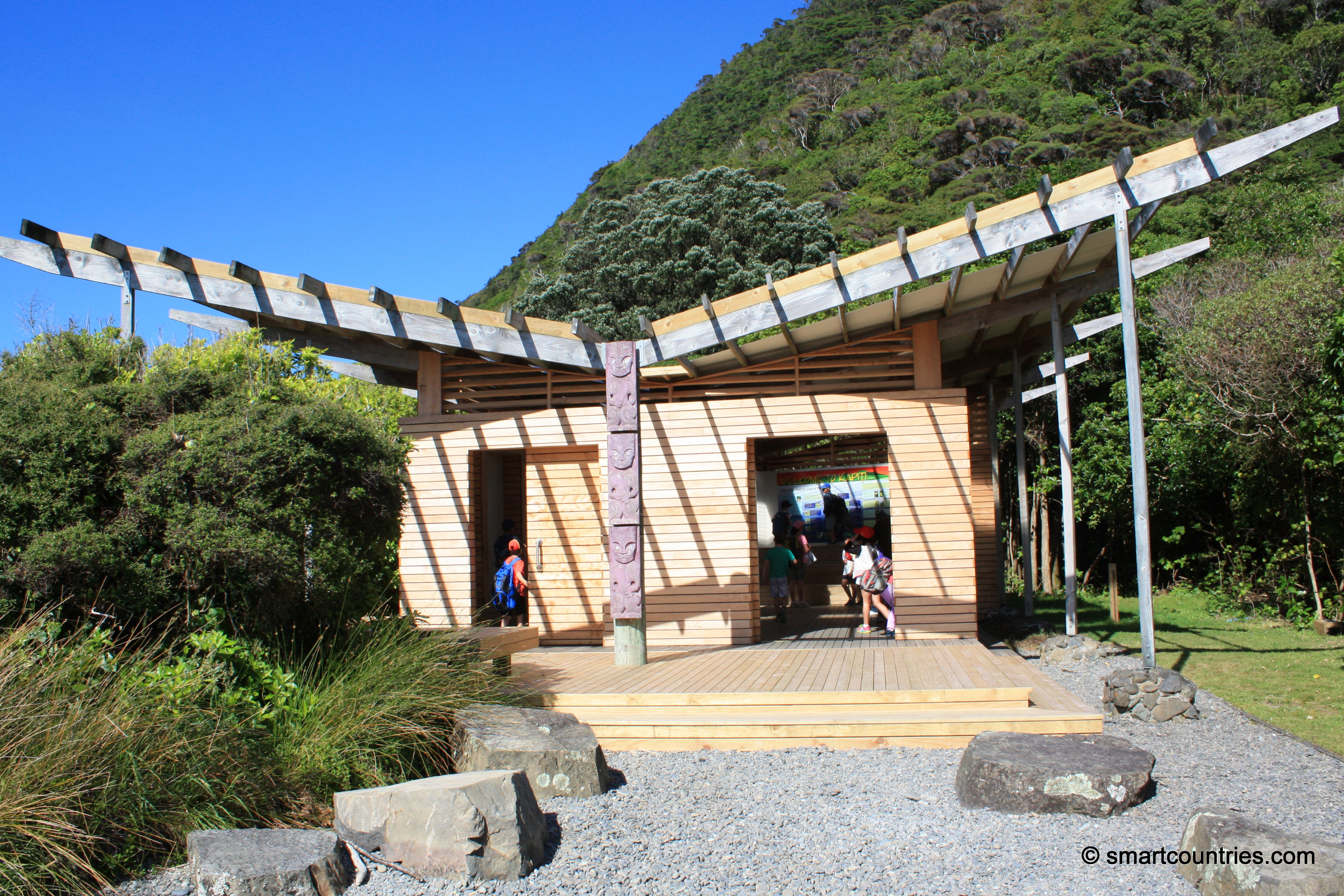
The shelter on Kapiti Island has information about tracks on the island and wildlife. It is located near the Rangatira Point where the boats drop off and pickup passengers.
ALL / About / Kapiti Island Shelter
All original royalty-free photos, shareable maps, and informative articles.
Kapiti Island Shelter
Page Views
This post has been viewed 1,719 times
Related Articles
-
South-West Kapiti
Kapiti Island photos, Cliffs, Islands, Landscape / Horizontal, Sea
View of the south-western Kapiti Island from the island’s highest peak.
-
New Zealand Robin on Kapiti Island
Kapiti Island photos, Birds, Landscape / Horizontal, Portrait / Vertical
The New Zealand Robin is a protected endemic species of New Zealand. Both the Stewart Island Robin and South...
-
Weka
Kapiti Island photos, Animals, Birds, Landscape / Horizontal
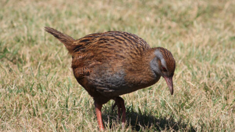
Weka are endemic to New Zealand. This one was located on Kapiti Island. Weka are flightless like many birds...
-
Tuteremoana View
Kapiti Island photos, Cliffs, Islands, Landscape / Horizontal, Sea
Southern view from Tuteremoana, the highest point on Kapiti Island.
-
The North Island Robin of New Zealand
Kapiti Island photos, Animals, Birds, Landscape / Horizontal
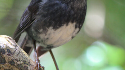
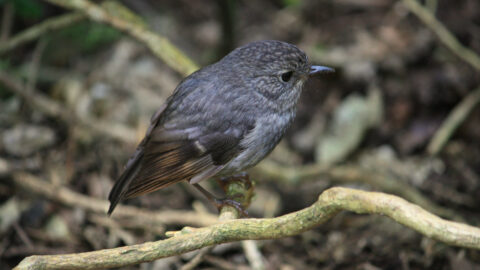
The North Island Robin is a small bird endemic to the North Island of New Zealand. They feed in...
-
Kapiti South-East View
Kapiti Island photos, Forests, Islands, Landscape / Horizontal, Sea
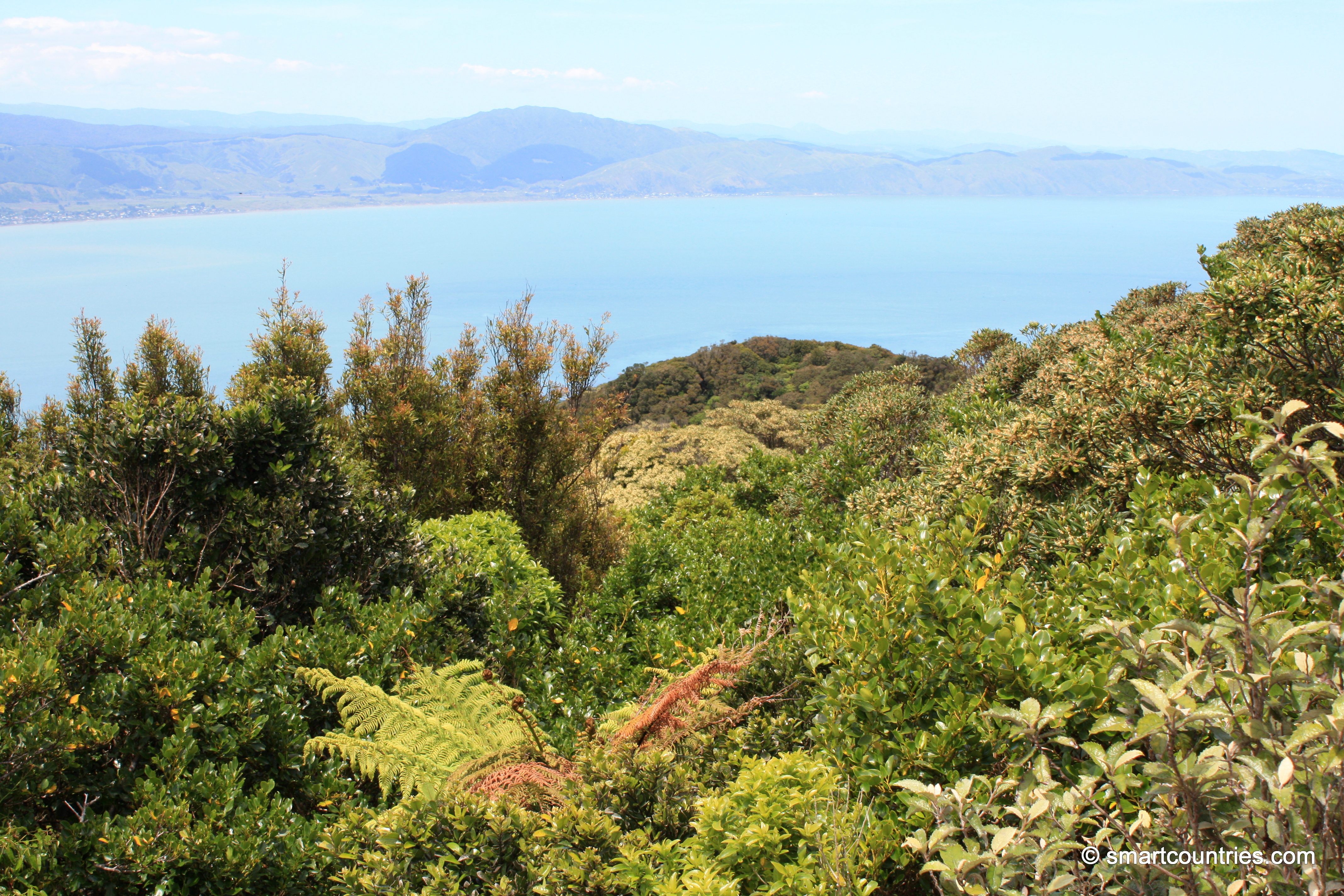
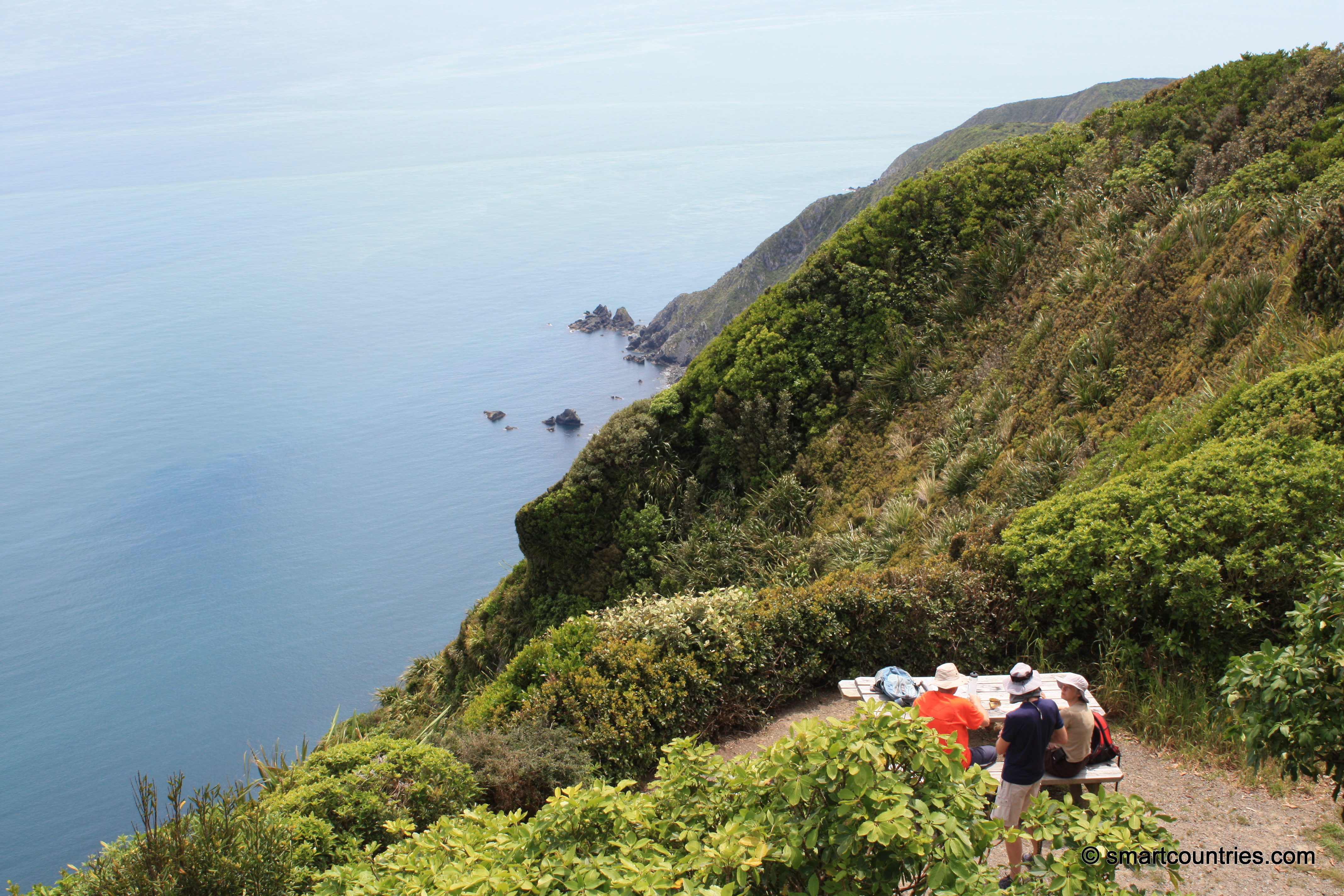
View looking south-east from the peak on Kapiti Island. In the background is the lower North Island with the...
-
Holes In Tree
Kapiti Island photos, Portrait / Vertical, Trees
A tree on Kapiti Island with holes all the way up the trunk.
-
Tuteremoana
Kapiti Island photos, Cliffs, Islands, Landscape / Horizontal, Sea
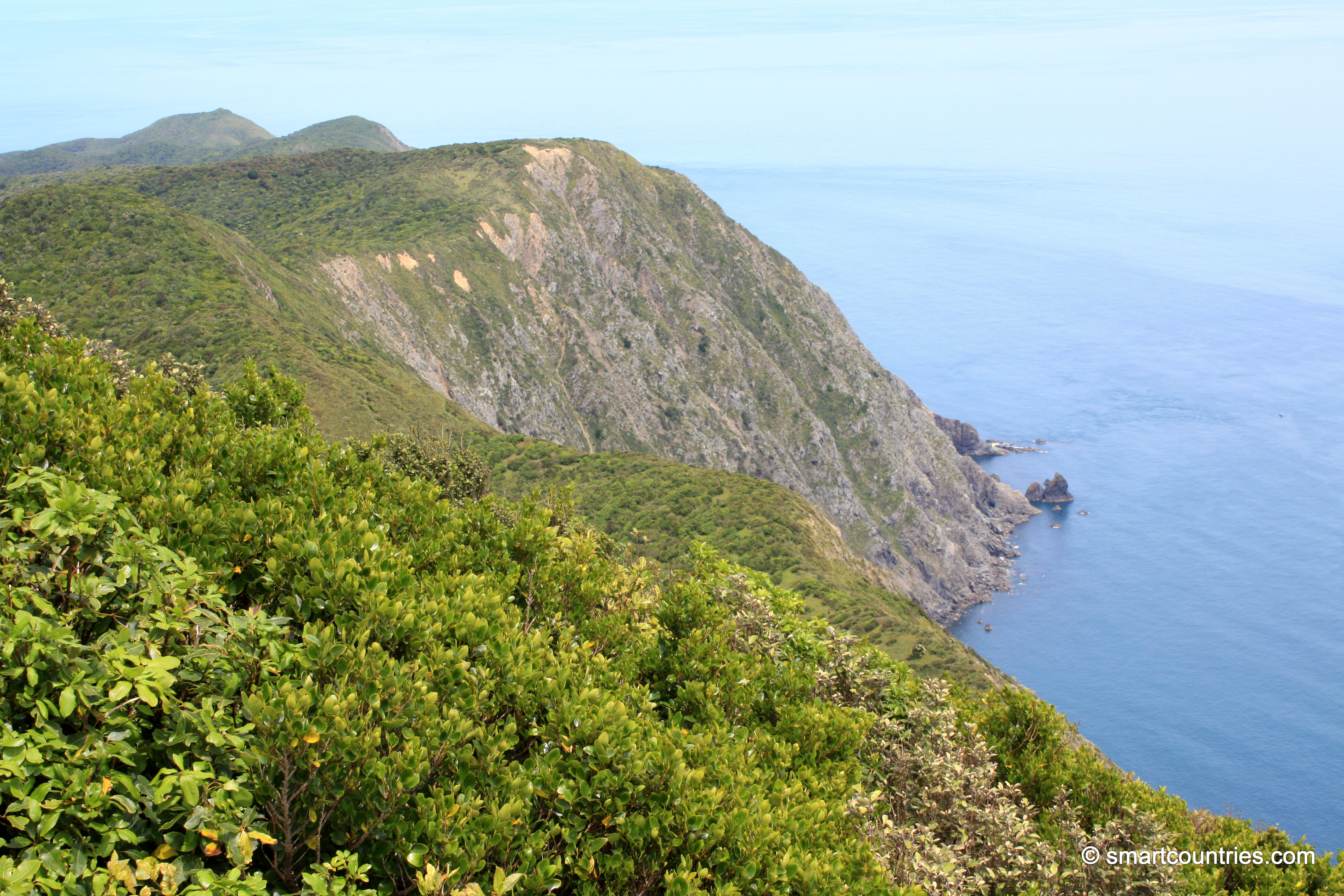
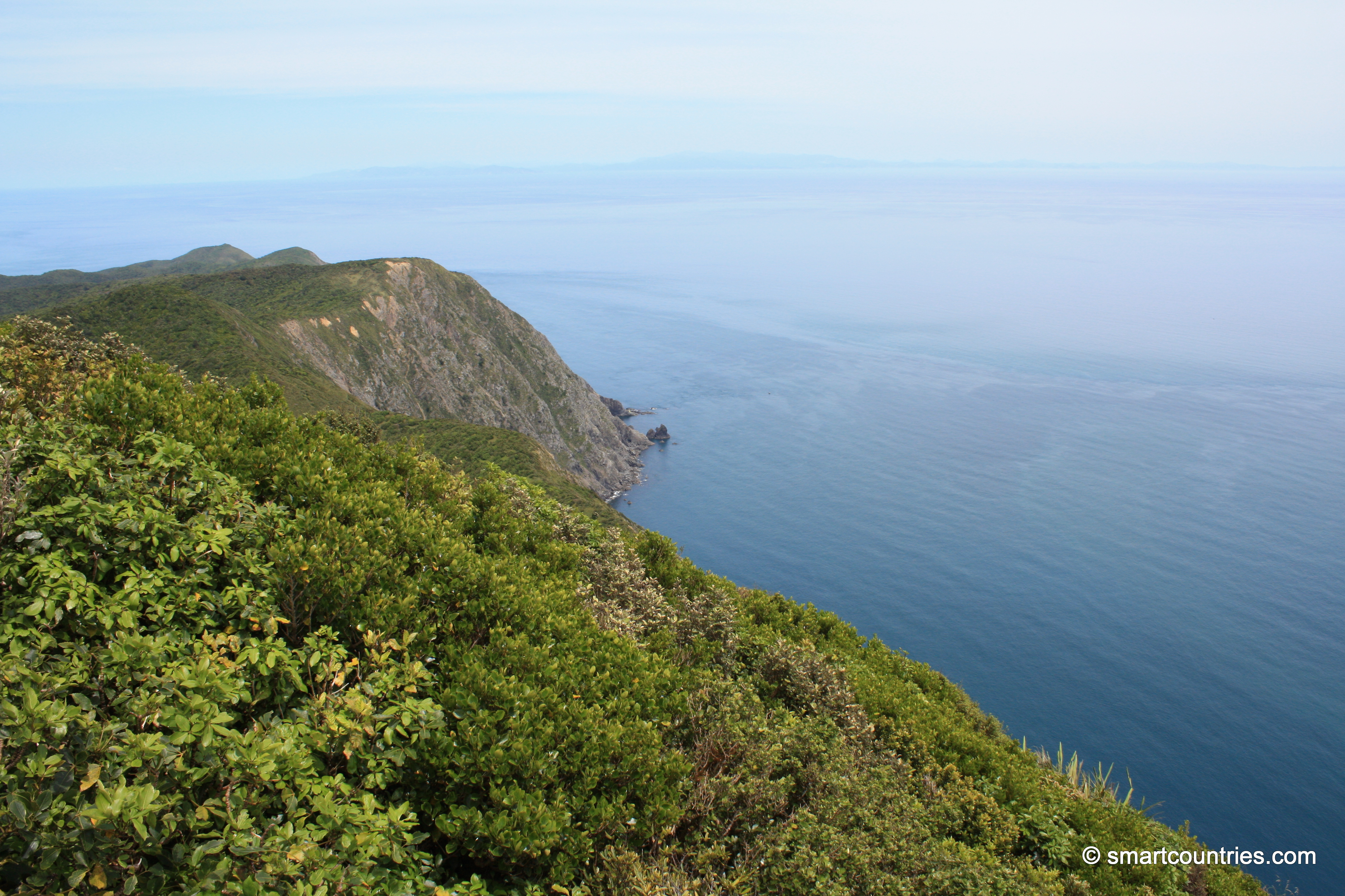
View of Tuteremoana, the highest point on Kapiti Island. At 521 metres high it may not be impressive by...
0 Comments
Latest Posts
Popular Posts
- Awakening New Zealand video (100)
- Iguazu Falls as seen from Brazil (86)
- Metrocable Medellin (77)
- Spinnaker Hill View (68)
- Pauatahanui Inlet (68)
- View from Whitby (68)
- Spinnaker Hill in Whitby Porirua (67)
- The Devil’s Throat (62)
- Aerial View of Iguazu Falls (61)
- Porirua Harbour & Papakowhai (57)
- Lake Wakatipu (57)
- Salto Rivadavia & Iguassu River (56)
- Lake Tekapo & Lupins (54)
- Cascadas at Iguazu (53)
- Close up of Salto Rivadavia (53)
- Salto Rivadavia Misiones Province (53)
Subjects
AccommodationAnimalsArchitectureBeachesBirdsBoatsBridgesBuildingsCarsChurchesCitiesCliffsCoralCultureExtra Wide HorizontalFlowersForestsHarborsHomesIslandsLakesLandscape / HorizontalMapsMenMonumentsMountainsPalmsParksPeoplePlantsPortrait / VerticalRiversRoadsRuralSeaShopsSkyscrapersSnowSunsetsTownsTransportTreesVideosVolcanicWaterfalls
Recent Comments
- Lance on Concrete Hut Wainuiomata
- DavidJ on Concrete Hut Wainuiomata
- Tony on Concrete Hut Wainuiomata
- DavidJ on Wellington Night Skyline
- Ben on Auckland City Skyline from Westhaven Marina in 1998